
Hiking Dude Blog
2025 2024 2023 2022 2021
2020 - Nov Oct Sep Aug Jul May Apr Mar Feb Jan
2019 2018 2017 2016 2015 2014 2013 2012 2011
11/18/2020
Call All 2021 Grounds Keepers

Here's your chance to hike lots of miles, make a good impact, and rock some cool gear.
I spent this crazy 2020 as a Granite Gear Grounds Keeper after learning about it from my good friend Wandering Pine. In this role, I was asked to hike some long trails, pick up trash, and track what I collected. In return, a bunch of awesome companies (logos and links below) provided me with their products to use on trail. What a deal!
Now, you can apply for 2021 and join the ranks of Grounds Keepers! But, don't wait too long because your app needs to be turned in before Nov. 25, and they'll want a short video of you, too.
Well, my planned long trail hiking got squashed by the pandemic, but I did get out on three backpacking trips. I hiked the Solitude Loop around the Cloud Peak Wilderness in Wyoming, YoYoed the Kekekabic Trail in North Minnesota, and hiked Minnesota's Shore-2-Summit loop.
The miles I didn't get to hike out in the wild, I more than made up for on 5 to 6 mile morning hikes on local trails. I've hiked about the same miles as an Ice Age Trail thru-hike (1100 miles).
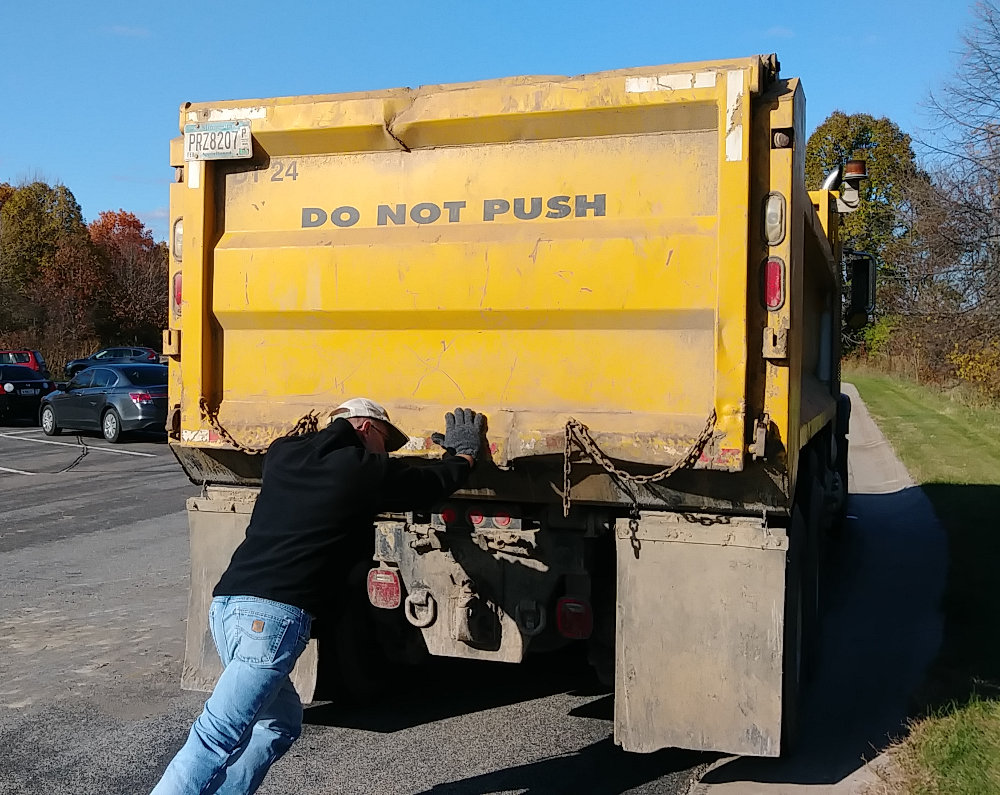
I also collected (and weighed) 503 pounds of trash this year, mostly on local morning hikes around town - and I still have 6 weeks left! So much, I had to help push the truck full of it away. :-)
I did hunt for trash in the Cloud Peak Wilderness, Kekekabic Trail, and Superior Hiking Trail, but it was wonderful to purposefully search for trash and not find very much out on the wild trails. I mostly picked up lost items and old junk, like a forgotten bear line, some rusted nails, a horse bridle, and tin cans.
Only a few wrappers and real trash, so from my view folks are doing a great job on the trail with packing out trash. In towns and along roads, its a different story. I expect some of it is blown out of garbage trucks every week, but aluminum cans, bottles, convenience store wrappers, and fastfood debris just keeps showing up week after week.

Plastic gloves and face masks were common, but expected. A surprise for me were the dozens of disposable vaping pens I found. Once I decided to start collecting them this is how many I wound up with. Instead of just cigarette butts of paper and filter, we now have metal, plastic, electronics, wiring, and a battery being discarded. I would be very interested in getting these things to include a cash return fee, like cans and bottles in some states.
I tracked my hikes here: Spotwalla and you can zoom in on any of the spots to see more.
Hike On!





Leave Comment
Posted: 11/18/2020
Posted: 11/18/2020
10/11/2020
Kekekabic Trail YoYo
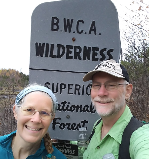
I completed a yoyo hike of the Kekekabic Trail in Northern Minnesota with my wife this week. We took 5 days 2 hours and 20 minutes to hike from the western terminus by Ely, MN to the eastern terminus on the Gunflint Trail road and back to the start.
It was a great adventure in the solitude of the Boundary Waters Canoe Area Wilderness, walking rather than the usual paddling.
Read all about the trail on my Kekekabic Trail page, or just read my hike report with pictures.
As a bonus, Kelly got recognized for the first recorded Fastest Known Time for a supported Female on the trail - see her FKT page!
Hike On!
Leave Comment
Posted: 10/11/2020
Posted: 10/11/2020
10/02/2020
Kek Prep
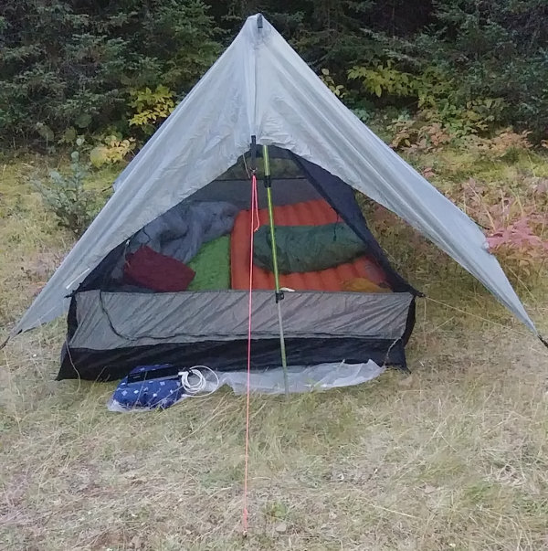
This will be our home for a week, starting tomorrow as we head out on a yo-yo hike of the Kekekabic Trail.
The Kek is about 40 miles long and we hope to hike from one end to the other and back to the start - that's 80 miles total. We're probably a bit late for top fall colors, but we should see some.
The Kek volunteer group has lent me a saw to carry and take care of any brush I have time to tackle. I don't expect much since trail crews were just out last month, but we'll see.
You can follow our progress on this Kek Trek page. (there's nothing there until we start)
Hike On!
Leave Comment
Posted: 10/02/2020
Posted: 10/02/2020
09/25/2020
Blue Blazes
(Click any photo for full size)
After we completed our Shore-2-Summit Loop, we took a day to give the Superior Hiking Trail a little TLC.
Last year, we participated in the Blue Blaze Blitz to repaint all the blue blazes along the entire 310 mile trail. This summer, the SHT Association asked me if I'd be able to touch up a section that was in need, so I said, 'Ya, sure, you betcha!'
I picked up a bag full of supplies from the front porch of my SHTA contact in Duluth which included a scraper, paint, brush, stencil, clean-up rags, and a map of the area to blaze. This time, we were assigned a 3.5 mile section just north of Duluth city limits. We would hike 7 miles since we would need to blaze in both directions.
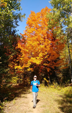
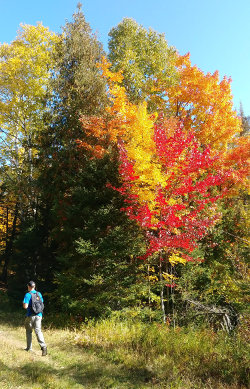
We were blessed with the third practically perfect day in a row to be out hiking. Great temperature, no bugs, no humidity, no weather, and trees in their colorful progression towards winter.
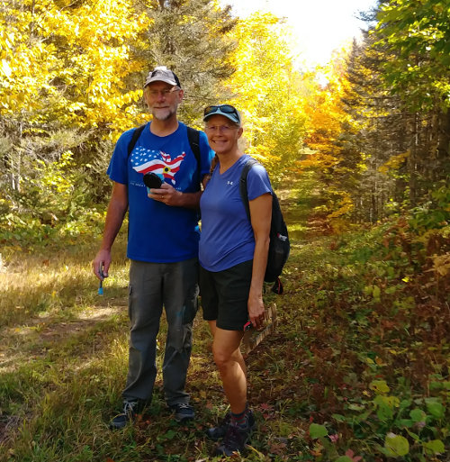
As you can see, the trail here is wide open and obvious. That's because this section runs on the C.J. Ramstad/North Shore Snowmobile Trail which is flat, wide, and brush-free. Blazes are not really needed along here, but many hikers like to see them occasionally just for reassurance.
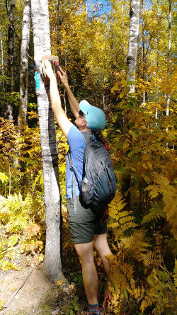
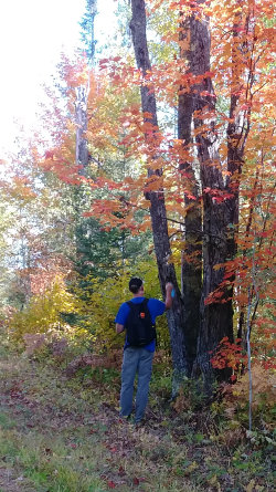
The vast majority of blazes we made were just touching up existing paint. We counted out 100 paces and would typically find a tree in the area that was easy to see and had an old, faded blaze. On the few occasions where there was no existing blaze, a scraper was used to remove lichen and dirt for a new blaze about 6 feet up a tree. Occasionally, I broke down brush that was growing in front of a blaze to make it more visible.
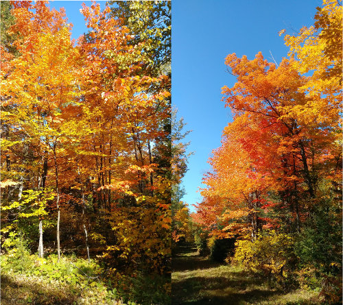
When the snowmobile trail portion was complete, we still had 3/4 mile to do where the SHT ran beside a road. The trail was obvious and there were very few trees, so we just touched up a couple carsonite posts we could find and one or two trees.
Unfortunately, the trail was so obvious that we walked right past the unmarked spot where the SHT abruptly leaves the roadside at someone's driveway while an obvious trail continues along the road. I had to come back with mineral spirits and wipe off a blaze I overenthusiastically made past the turn-off.
To help make the turn more obvious, we put a SHT sticker with a blue arrow on the only small tree around and added a sticker to a wooden sign in the driveway. We got the opportunity to see if the stickers helped immediately.
A female thru-hiker came walking down the trail just after I got the extraneous blaze wiped off so I stopped to see what she would do. She walked right past the driveway and kept going on the obvious path just as we had done. So, I asked if she was hiking the SHT and pointed out that it left the roadway here when she said she was. Whew, catastrophe averted, but I expect it is a very commonly missed turn.
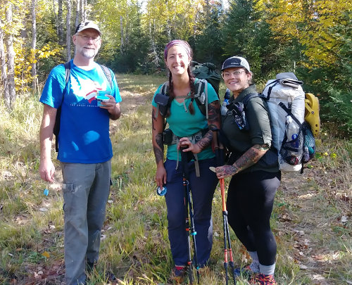
Speaking of thru-hikers... Besides the one at the driveway, we ran into three others, plus a solo man on a section hike, and a couple that looked like they were on a long trek (but they did not stop to chat). These two young ladies visited with us for a few minutes which was the highlight of the day! They looked way too fresh and energetic to have been on the trail since the Canadian border nearly 3 weeks ago.
It is amazing to me how many people are hiking the entire SHT this year. These two each received a Hiking Dude sticker for their water bottles.
All the thru-hikers we met were female, and two of them were solo hiking the trail.
You can see a track of our walk HERE - it is the tiny bit down by Duluth.
Please consider volunteering to help maintain the trails in your community. And, tomorrow (Sept. 26) is Natl Public Lands Day and there might be a volunteer event near you to join.
Hike On!
09/24/2020
Minnesota Shore 2 Summit Loop
(Click any photo to see original size)
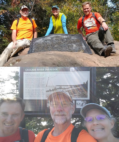
On this adventure, I took my wife and my brother-in-law on a 36-mile loop hike to touch both the highest and lowest points in Minnesota. This is a hike I've been wanting to do for a few years, just to see what it is like since I've not heard of anyone else doing it.
You can see a track of our walk HERE
We drove to Duluth Saturday evening and stayed overnight with the BiL, otherwise the day would be half over before we started hiking if we drove all the way from the Twin Cities.
On Sunday morning, we left at 7am and drove up the North Shore past Cascade River state park, onto County Road 7, and then wiggled our way up to the intersection of forest road 157 and 158, also known as Cascade River Road and Bally Creek Road. This is about the halfway point of our planned hiking adventure.
Just a hundred feet or so north, the CL Ramstad snowmobile trail intersects FS158 and that is where we parked.
Just as we were leaving our car to head north up the dirt road at 9:36am, we heard a shotgun blast very close. We quickly changed into our orange and yellow shirts. Less than a hundred yards up the road, we walked past a pick-up truck with three hunters and a dog. As I'd find out throughout the day, driving a pick-up along forest roads is a preferred method for some 'hunters' around here. But, it probably has some success since we saw four or five grouse along the road.
The first 6 mile leg of our route was simple - follow FS158 to the northern end. The road Ts and at the intersection is the trailhead for Eagle Mountain. The road walk was easy, and it was nice for a morning walk through the forest, but there's not much to take pictures of.
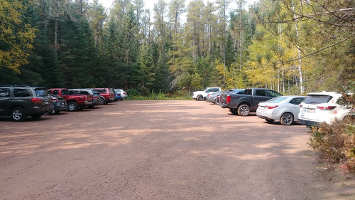
We weren't the only ones that thought a Sunday hike to the highest point in Minnesota was a good idea. Over 20 cars in the parking lot, and 52 people on trail, but it didn't feel too crowded.
I self-registered and got our permit at the trailhead kiosk. The locked box where I deposited the permit was so full, I had to crush it into the slot on top and hope it stayed. The permit is mandatory but free since we're doing a day hike in the Boundary Waters Canoe Area Wilderness.
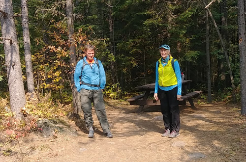
There's one nice picnic table at the trailhead so we stopped for a snack and used the pit toilet. If you visit here, be sure to bring your own toilet paper - there were 6 empty rolls and 2 usable when we started our hike - they were all empty by the time we finished.
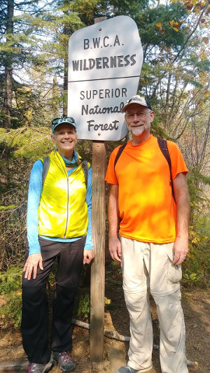
The trail starts at about 1750 feet elevation. About .9 miles in, you enter the BWCA at Whale Creek - the sign is kind of obvious.
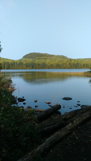
At 2.1 miles, a wonderful view of Whale Lake opens to the north with a hill (excuse me, mountain) across the lake that is just 100 feet shorter than Eagle Mountain.
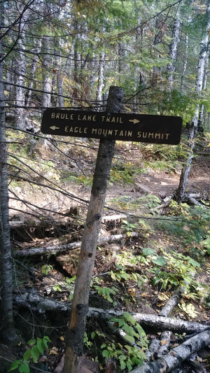
At 2.4 miles, the Brule Lake trail splits off the Eagle Mountain trail to continue west for another 5 miles or so. It stays flat, but here is where we start our climb up Eagle Mountain, rising from 1900 feet up to 2301 feet in a little over 3/4 mile. That's only 400 feet with a few steep spots, but mostly a nice, consistent ascent.
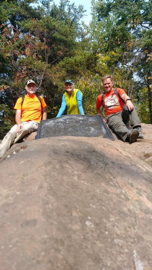
OK, so what's at the top?
Well, I was very surprised to see such a memorial here! There is a geodetic marker embedded in the summit rock as I expected, but there is also a very large metal plaque installed by the MN Historic Society - Read It. There is also a large old first aid case acting as a geocache, full of Clif bars, bandaids, and a couple trail registries. I did not sign in, but did leave a couple stickers for anyone to take.
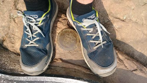
The most interesting thing about the summit was the geodetic marker. It was cemented in place in 2002 and gives an elevation as 2298.15 according to the stamped brass marker. That's 3 feet short of the 2301 feet advertised height - what's the deal??? (actually, the marker is so defaced that I had to find an older image to read.)
I looked at the past few days in the trail registry and it looked to be an average of about 20 new sign-ins each day. This is a POPULAR trail!
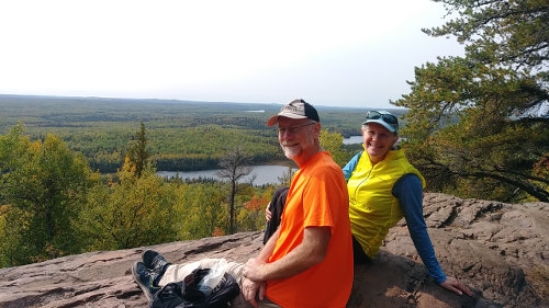
One thing missing at the summit is a view. It is covered in forest, but a wonderful view is just a few feet down from the summit where a rock plateau makes for a wonderful rest spot to scan the forest below all the way to the vanishing horizon with 4 or 5 lakes in the woods below.
We visited a week or so too early for great fall colors at this spot, but the sea of green below us will be brilliant yellows around the end of September.
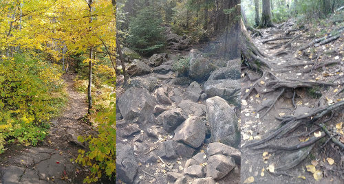
After a short rest, we headed back down the trail at 1:15pm to make room for others at the top. The trail itself was a mix of easy flat tread, roots, and rocks. So much traffic tends to wear trail tread down, increasing erosion and making it a rougher hike. I'd recommend using hiking poles if you're used to them.
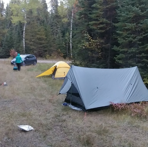
We had a nice lunch at the trailhead picnic table, very surprised that it was not being used. That was followed by a brisk 6 mile hike back to our car. Since we were back by 4:30, we decided to 'glamp' and drove into Grand Marais for dinner at Voyageurs Brewery instead of cooking our own.
Just before sunset, we returned and set up camp for the night. We just pitched our tents on the snowmobile trail since we were on the Superior forest. It was a warm, dry, breezy evening with no bugs and the stars were brilliant.
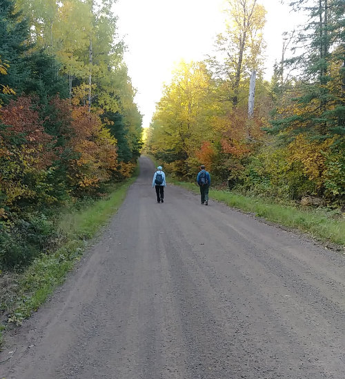
Our second day started with another brisk 6-mile hike along dirt forest roads. Since today was Monday, there were only a couple log trucks and no hunters out. Most of this section was across the higher Minnesota forest, with a few rises and falls over hills as we slowly dropped only a hundred feet towards Lake Superior at the very end.
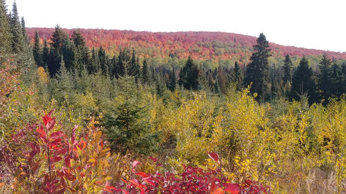
The hills closer to Lake Superior had more color, so we were treated to many red, orange, and yellow trees along the way.
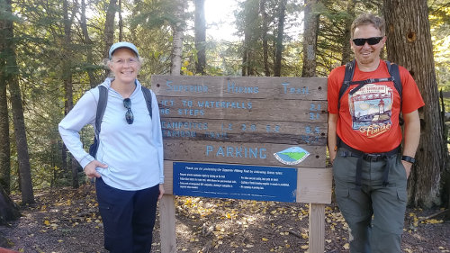
Since we started hiking around 7:30am, we reached the Superior Hiking Trail at about 9:30 and headed down the last 3.3 miles to the lake. Well, it was actually down, and then up, and then down, and then up, ... as we hiked into and out of every side gully that drains into the Cascade River. Here's what I mean...
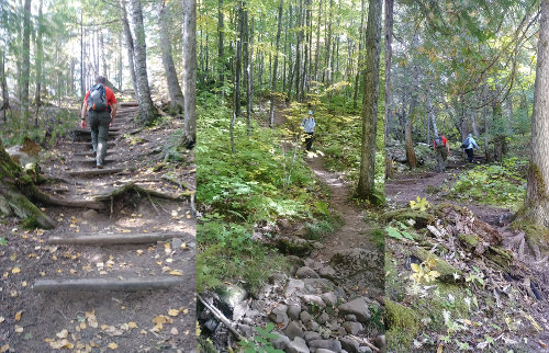
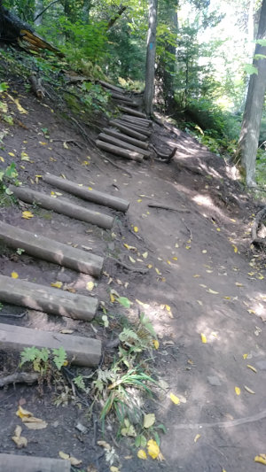
Since the SHT runs up both sides of the Cascade River, this 7 mile loop is very popular. It is a great example of the SHT being loved to death by thousands of hikers like us visiting it each year. With so many footsteps, the trail tread, erosion structures, and steps eventually wear out, as you can see here. This part of the SHT is in great need of some maintenance. Once the developed trail erodes, people tend to create their own paths and everything breaks down even faster.
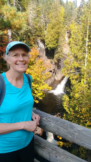
The lowest half mile or so gets the most traffic since it has beautiful waterfalls, constructed bridges, and a nice parking area directly on Highway 61. We encountered about 40 people, and there were people waiting to get a photo at this spot - probably the most photographed spot on the Cascade River. :-)
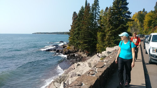
We played Frogger to get across Highway 61 to reach Minnesota's lowest point at 602 feet on the shore of Lake Superior at 11:45am. So, we made it from the high point to the low point in about 22.5 hours. We enjoyed lunch, lake, sun, and breeze for a half hour and then started our climb back up to our car.
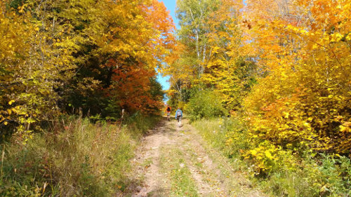
Instead of hiking up the SHT, I decided to take an alternate route using the cross country ski trails in the park. What a great idea! Insted of PUD after PUD, the ski trails made a constant, gradual ascent. Going this way, we were treated to an easy walk through quiet forest with many grouse, fall colors, and no tourists.
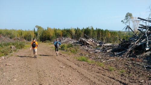
Our ski trail connected to an old forest road which brought us back to the dirt road we had walked down, but this new route cut off about a mile of road. To get more off-road miles, we followed two sections of the CL Ramstad snowmobile trail back. We hadn't taken them at first because I was concerned they might be swampy and overgrown. As it turns out, the trail was a wonderful walk even though it cut through a logging operation for a half mile.
We reached our car at around 3:45pm for a total Shore to Summit loop time of 30 hours.
Hike On!
Leave Comment
Posted: 09/24/2020
Posted: 09/24/2020
09/20/2020
Done Hiking Today

I finished hiking for today. You can check out my current location on the map and I'll post about my day when I am in coverage.
Leave Comment
Posted: 09/20/2020
Posted: 09/20/2020
Older Posts Newer Posts
Find more Hiking Resources at www.HikingDude.com


Follow Me
Recent Comments