
Hiking Dude Blog
2025 - Aug Jul
2024 2023 2022 2021 2020 2019 2018 2017 2016 2015 2014 2013 2012 2011
08/28/2017
Day 34: Paysaten
 I walked 54190 steps on the trail today.
I traveled about 23 miles today.
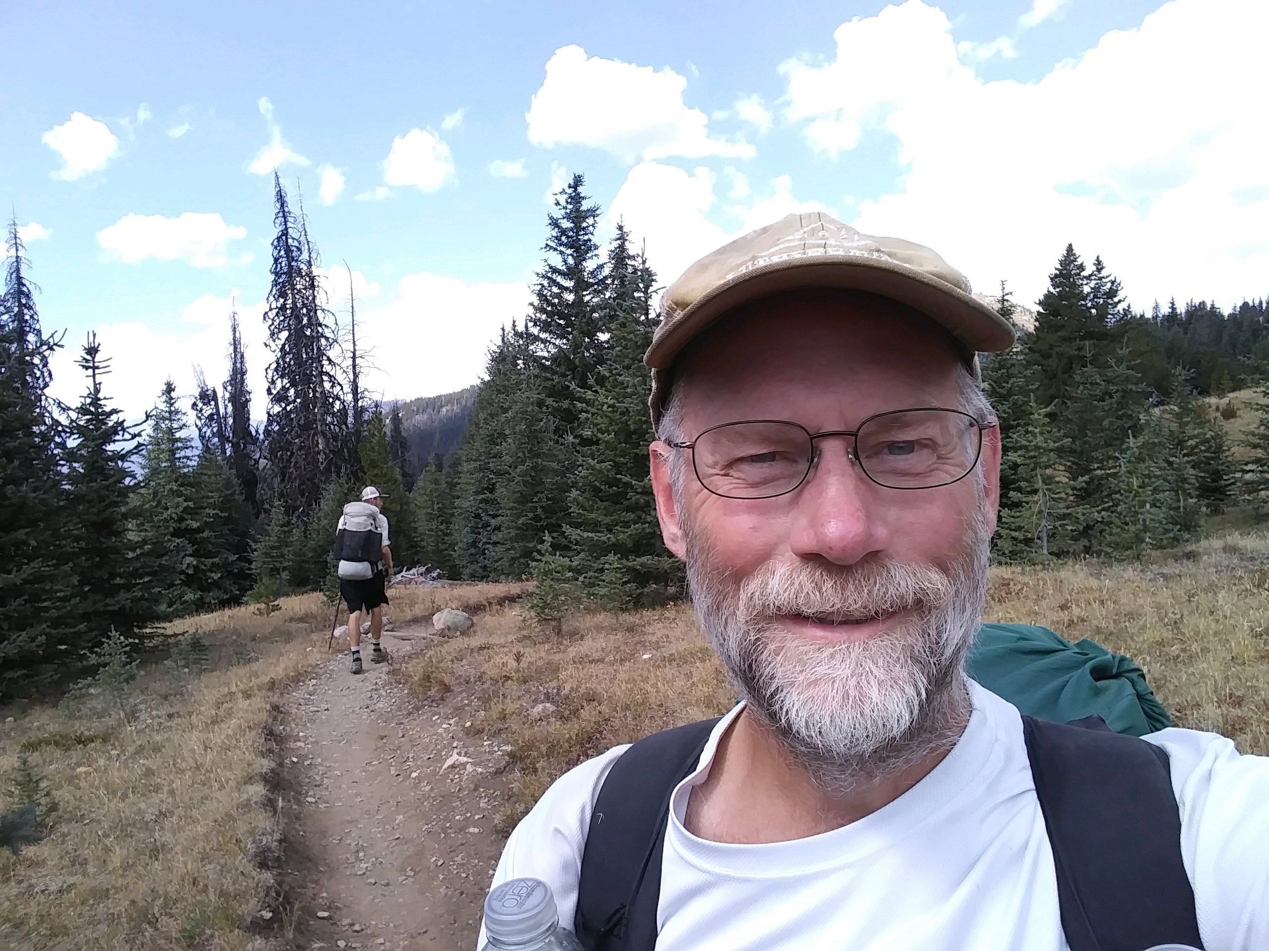
8/23/17 Good bye, cows! After climbing a few hundred more feet, chasing cows out of the way, and bush whacking when the trail disappeared, we finally entered the Pasayten Wilderness and an entirely new experience. The trail is no longer 2 or 3 inches deep of dust and cow manure but is now a beautiful, cared for tread that carries us through wonderful scenery. We are only 15 miles in but it has been super. We've even been able to see tracks from hikers days ahead of us, so it's a fun game to wonder where they are now and if we might be getting closer to them. Mountain views have been constant and the arid desert terrain has given way to high mountain meadows and forest. I think we're done with sagebrush and stickers. We met 4 people on trail today - We can't remember the last time we met other hikers but it might have been pyramid lake. Two guys were on a week long trip and another couple were doing a 5 day loop. Both of them had met Thumbalina last night so we know she's just a day ahead of us. We are getting plenty of water and food. I was actually stuffed after my dinner of sausage, tuna, and tortillas tonight. We are set up at the tungsten mine camp at about 6800 feet and at the 633 mile mark of the PNT even though we've hiked farther than that. Tomorrow morning, we cross Cathedral Pass which is the highest point on the PNT.
Leave Comment
Posted: 08/28/2017
Posted: 08/28/2017
Day 35: Fire on the Mountain
 I walked 58470 steps on the trail today.
I traveled about 24 miles today.
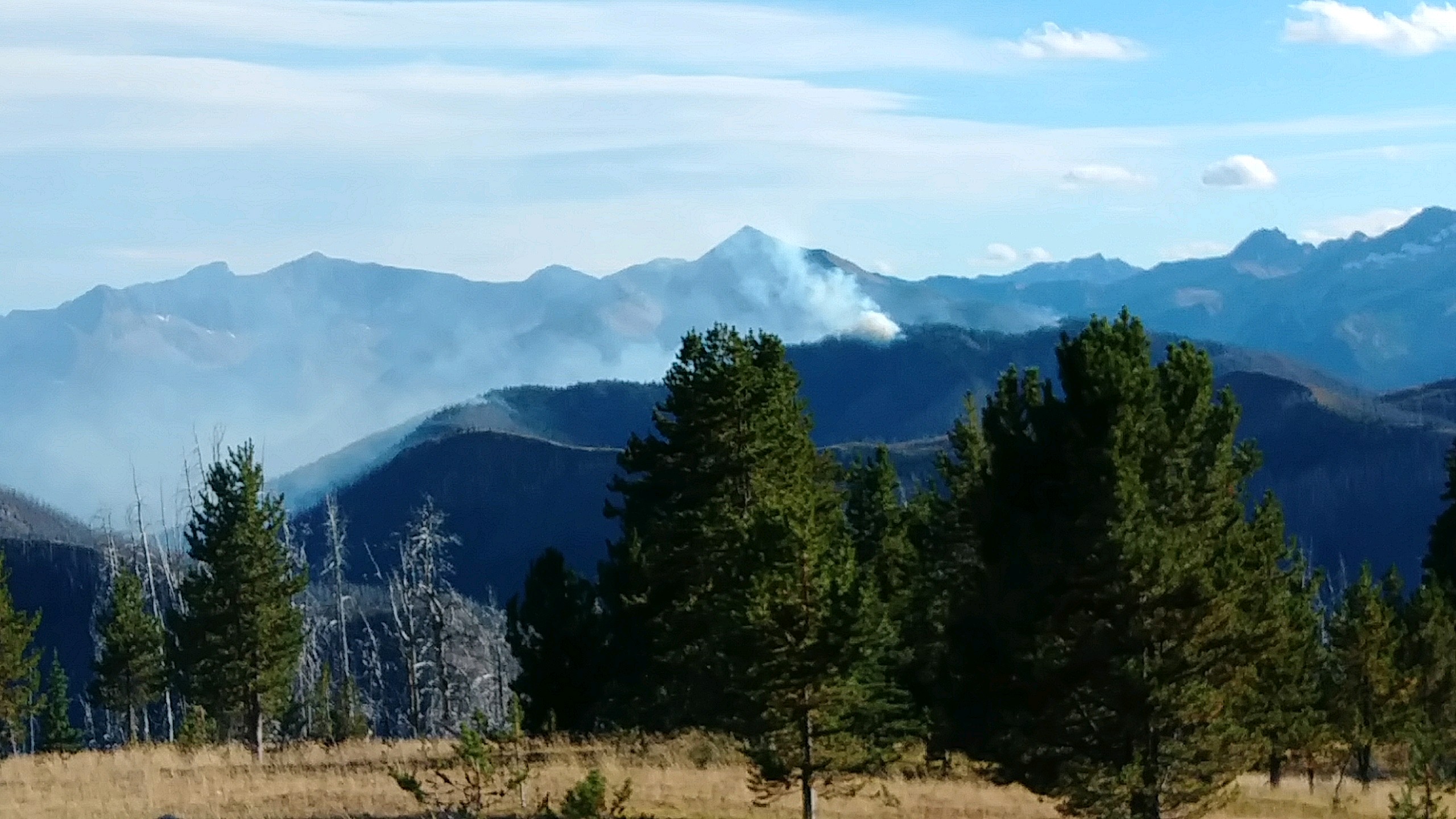
8/24/17 It was cold when we got up and cold when we went to bed and cold all day. Josh wore his down jacket all day. I enjoyed the cooler temp since I hardly sweated on the uphill climbs. Our day started with a nice hike up and over cathedral pass with amazing views out across the mountain ranges. After that, we had super views all day as we climbed more ridges and passes. We met a couple out on a 10-day trip this afternoon, and a man and his dog out working in the woods for a week. Shawn and Bandit are doing data gathering for the forest service and we had a nice chat for awhile. Toward the end of the day, I went ahead of Josh since he had no problem catching up. At an intersection, I went the wrong way but figured it out after about 5 minutes as the trail descended instead of climbing. My concern was that Josh would take the correct trail and be far away by the time I got back on course. Luckily, he saw my footprint in the dust going the wrong way and we met as I was heading back. So it all worked out. On our last ridge walk of the day, we could clearly see the Diamond Creek fire burning just a couple miles south of the trail. We could see orange flames consuming trees, and smoke fortunately being blown east while we were north. This fire had been threatening to closethe PNT for the past couple weeks so we're very glad to be past it. We reached camp just as the sun was sinking and just had time to set up, eat, and bundle up to try and stay warm all night. I'll let you know how that goes.
Leave Comment
Posted: 08/28/2017
Posted: 08/28/2017
Day 36: Ice in the Water
 I walked 45650 steps on the trail today.
I traveled about 18 miles today.
8/25/17 I made two lightweight camping quilts for my long hikes. One has half the insulation as the other. Josh has been using the lighter one but last night we swapped because it was cold and I stay warmer sleeping. I didn't sleep well. It got cold. We had ice in our water bottles this morning! So, we broke camp quickly and started hiking even before eating. A vigorous climb up Bunker Hill warmed us up and gave us wonderful views in all directions. Down the other side, we entered a large burn area of nothing but dead snags and down trees. The trees seemed to do their best to land on the trail when they fell. I counted 158 that we had to climb over in 1/2 mile and then stopped counting. But, future PNT Hikers don't need to worry because we met a trail crew working their way from the Pasayten River up Bunker Hill clearing out logs from the trail. The four of them each got a hiking dude sticker. We passed Thumbalina this morning. We had another nice but short chat and may see her again down the trail. She had hiked through some wild areas all on her own. After crossing the Pasayten River on a convenient log, we hiked through the burned forest another 6 miles until the trail headed up a new draw to the west. This live forest was green, fresh, cool, and very pleasant to travel through on our way up to our campsite at Chuchuwanteen Creek. We're much lower tonight so I hope to stay warmer. I'm looking forward to the wonders that come our way tomorrow. We did see one beautiful deer with velvet antlers today.
08/29/2017
Done Hiking Today
I finished hiking for today. You can check out my current location on the map and I'll post about my day when I am in coverage.
08/30/2017
Done Hiking Today

I finished hiking for today. You can check out my current location on the map and I'll post about my day when I am in coverage.
Leave Comment
Posted: 08/30/2017
Posted: 08/30/2017
08/31/2017
Day 37: PNT & PCT
 I walked 47670 steps on the trail today.
I traveled about 20 miles today.
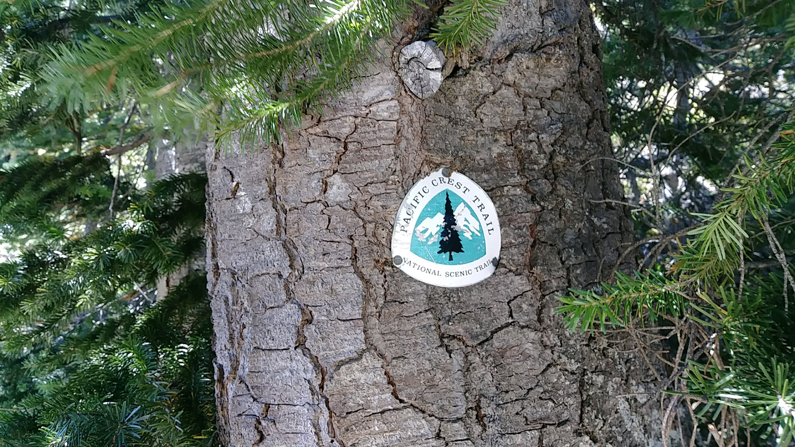
8/26/17 Brrrr - Another cold night for sleeping and morning for hiking. Three layers of clothes and socks on my hands kept me warm enough. Through the woods, up, up, up and over Frosty pass to our intersection with the Pacific Crest Trail. Immediately, three hikers went by. Less than five minutes later, we passed a couple more. All in all, we ran into over 30 people on the 14 miles of shared trail - more than we will see on the entire rest of the PNT. The PCT tread was amazing - smooth, level, wide, and well maintained. I got spoiled! At the end of the day, three young hikers came by our camp and we had s nice chat. Nick and Matt will be hiking the Washington section of the pct after doing a shorter hike with Naomi.
Leave Comment
Posted: 08/31/2017
Posted: 08/31/2017
Day 38: HOT
 I walked 52120 steps on the trail today.
I traveled about 21 miles today.
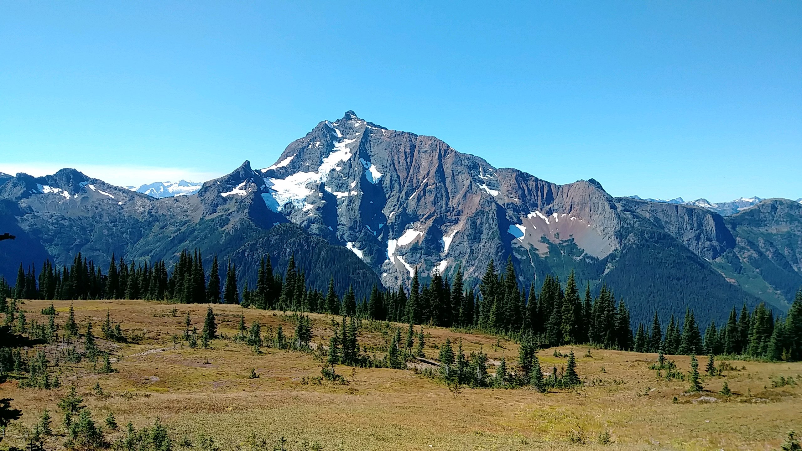
8/27/17 All morning was hiking up to Devil's Dome crossing over two passes on the way. Great views of Jack Mountain with glaciers and a pinnacle peak made the climb enjoyable. The top of the dome was a wonderful rest point. This will be the last time we're over 5000 feet until we reach the Olympic peninsula. Being off the manicured PCT and back on the PNT was a rude awakening for me, but it's our hike. We plunged 5000 feet down from Devil's Dome to Ross Lake in less than 6 miles, changing from alpine to pine forest to humid, hot dense woods. We walked a trail along the lake to our camp spot. The trail was very cool in spots when it got closer to the lake. We had a cliff rising beside us, the lake right below us, and the sun beating down on all of it. It was beautiful but hot. When we got to the campsite we hoped to use, it was full with 8 kayakers but one moved her tent to make room for us. We went swimming off a dock for our first bath in a week. After that, we chatted with our new friends. They had a ton of food and invited us to eat with them. So, we're now completely full and trying to fall asleep on top of our quilts since it is still stifling hot. Such a huge change from the last few nights when we had to wear all our clothes to stay warm.
Leave Comment
Posted: 08/31/2017
Posted: 08/31/2017
Day 39: Ross Lake
 I walked 47034 steps on the trail today.
I traveled about 22 miles today.
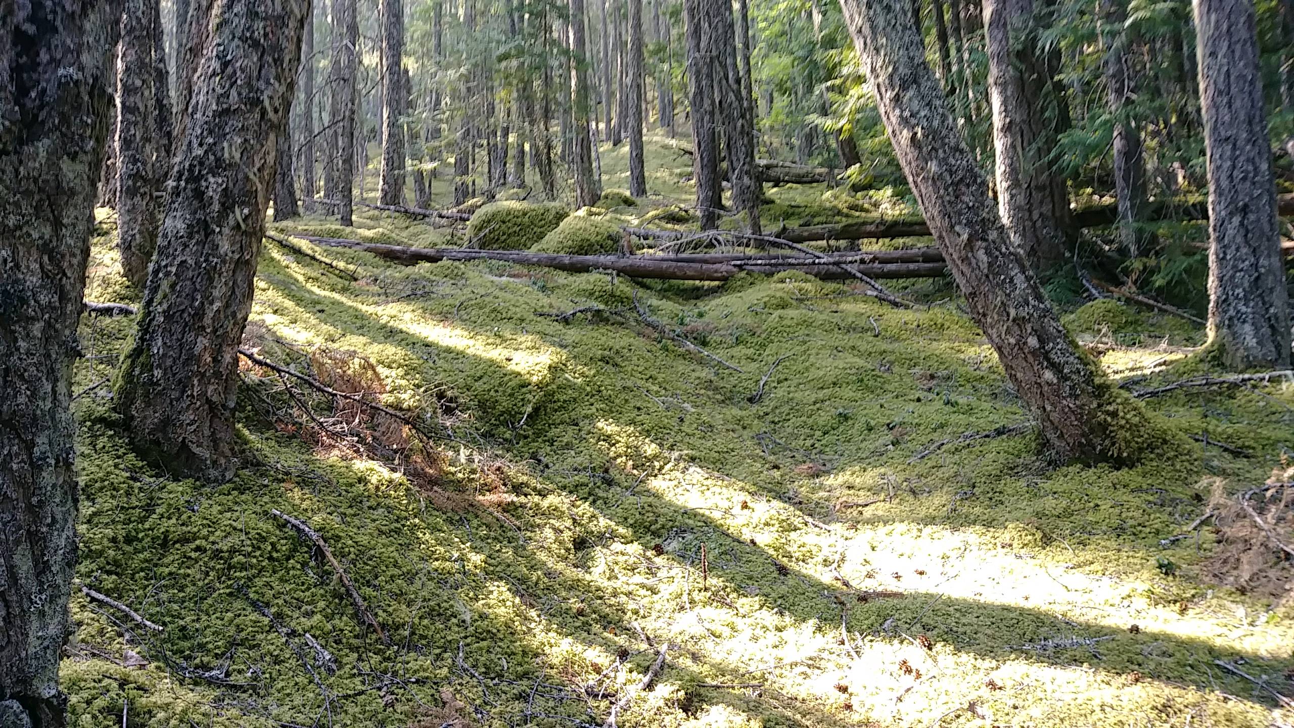
8/28/17 Long hike around the lake to reach our campsite on the other side which was just about 1 mile away by a straight line. Some beautiful rivers, falls, and bays all along the way. The forest at this low elevation is so much different than up high. Big cedars, lots of moss, ferns, and decaying logs make it like what we expect as we approach the coast. Ross Lake Resort had food packages for us so we can hike the next 5 days through the forest and mountains. The resort is very cool. It is a collection of cabins floating on the lake. It was originally the housing for the workers that built the dam that created the lake. Since it was over 95 degrees, we rested there for 3 hours and charged electronics. They even let us use their WiFi. We chatted with a very nice lady that had two huge Swiss dogs. In the evening, we completed our hike to the Pumpkin Mountain campsite where we have the place to ourselves. The big toes on both feet are getting abused a bit from these shoes but nothing serious yet. My left knee has taken some hits and twists the last few days but still works fine while hiking.
Leave Comment
Posted: 08/31/2017
Posted: 08/31/2017
Day 40: Old Growth
 I walked 43340 steps on the trail today.
I traveled about 18 miles today.
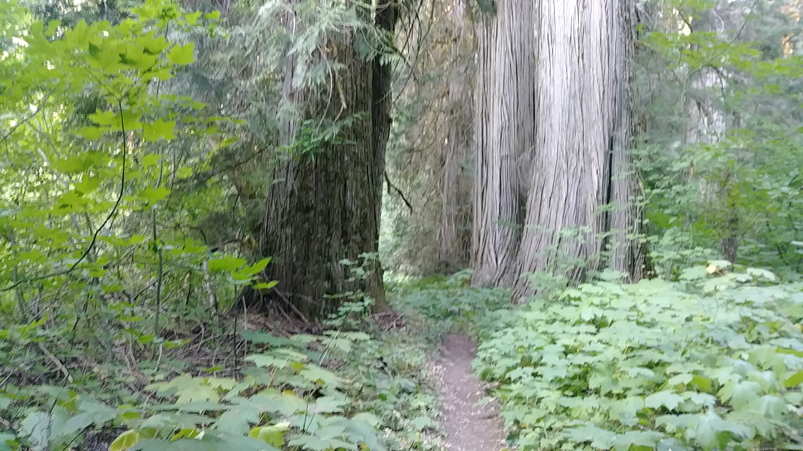
8/29/17 We hiked from the lake up the Big Beaver Creek valley, over Beaver Pass, and down into Little Beaver Creek valley. Then, we walked up this valley to our campsite. All of this was in shaded, damp old growth cedar and pine forest. Some of the trees were massive and much of our walk felt like dinosaurs should be roaming around. All we saw were some toads and tons of flies and mosquitoes. We wore our bug pants all day. We did cross paths with two big groups of backpackers but they didn't stop to talk. And, we woke a couple in their tent at 2:30 when we walked past. They thought we were a bear. Since we were in forest all day, there were no mountain views to be had but the smoke in the air would have prevented them anyway. Today was pretty rough for my body. My left shin started aching and just got worse through the day. I wrapped it while hiking in the afternoon, put it in the icy creek tonight, have it elevated, and took some pain relief. It is quite swollen in one spot so I'm a bit worried. Nothing to do but forge ahead at this point. Also, at the campsite, a sharp stick poked the inside of my left foot above the heel and blood started pouring out - more than I'd expect from a little stick. This was on the way to the creek to soak our legs so that helped stop the bleeding. When I looked closer, the prick was right into a blood vessel there which is probably why it bled so much. Well, at least we have way too much food! Two big passes to cross tomorrow so that's lots of up and down.
Done Hiking Today

I finished hiking for today. You can check out my current location on the map and I'll post about my day when I am in coverage.
Leave Comment
Posted: 08/31/2017
Posted: 08/31/2017
Older Posts Newer Posts
Find more Hiking Resources at www.HikingDude.com


Follow Me
Recent Comments