
Hiking Dude Blog
2025 - Aug Jul
2024 2023 2022 2021 2020 2019 2018 2017 2016 2015 2014 2013 2012 2011
03/05/2019
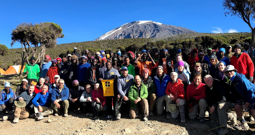

Our last meal on the mountain was a wonderful breakfast in the Thunder Dome. Yes, it had been recovered after being blown away last night. A few rips in the top, but still able to stand. After breakfast, we had the traditional Thank You ceremony with the support team. This is where the clients present monetary tips to the various support roles - porters, cooks, toilets, guides, and lead guide. It's customary to present the money and announce the amounts in front of all so there is no chance someone might pocket some that should be distributed. A couple fun songs and we were ready to scurry down the hill to a bus, lodge, and showers!
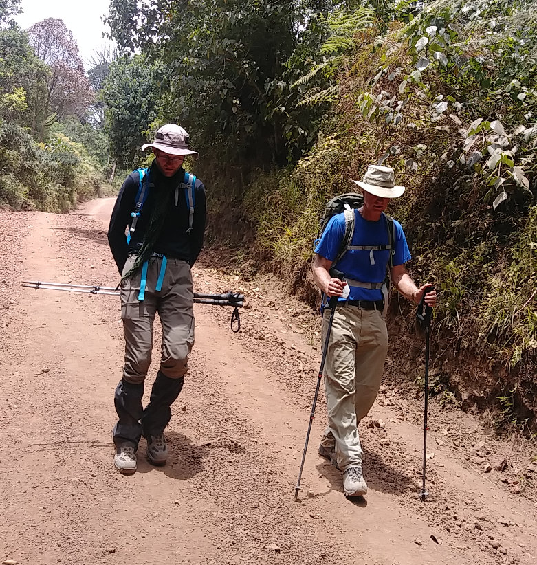

Surprisingly, today's long walk downhill caused more slips and injuries than the rest of the trek. The trail was fairly steep through a beautiful rain forest with lots of terraced steps that meant hard pounding of feet. That trail opened into a gravel road for another couple miles. The sand on this steep road was very slippery and I heard that most of us slipped at least a few times on the way down. I slid four times myself, with no injury but just more stress, and I saw one person not in our group actually fall ahead of me.
One highlight of this hike was that there were many monkeys causing a ruckus in the trees overhead a couple times. The other highlight was reaching the exit at Mweka Gate and having a cold beer while waiting for the rest of our gang. When we were all down, it started to rain as we loaded the buses, and there was even a few claps of thunder up the mountain. We drove to Meru Meru Lodge for showers, drinks, and a celebration dinner, followed by sleep in a luxurious bed.
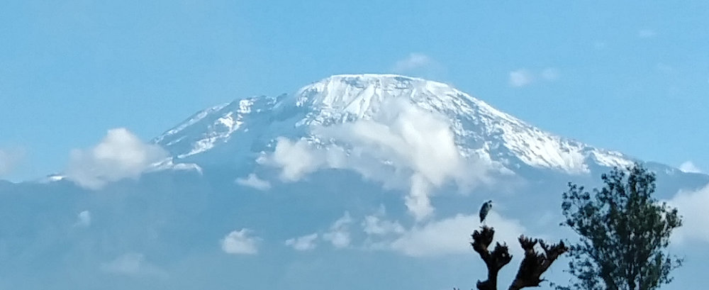

Even though the wind was a challenge on the mountain, we were very, very fortunate with weather on our trek. The wind destroyed some camps, and when we go off the mountain, it rained. Higher up, it snowed! This is the view of Kilimanjaro from our lodge the next morning when we woke to clear skies. Compare that to the photo of our mountain family above and you can see that our entire summit day would have been through fresh snow today.
We hiked from 12,500ft down to 5,400ft over a distance of about 7.5 miles.
Posted: 03/05/2019
03/06/2019
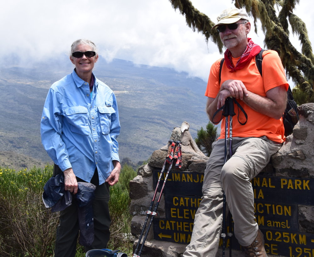

Now that our Kilimanjaro Trek is finished, I have some thoughts, suggestions, advice, or tips that might help someone else when planning to climb the mountain.
Things We Did Right
- Practice Hikes - we hiked 5 to 7 miles nearly every morning, in the cold snow and ice, for about two months before our trek. We hiked up the steepest hill in our area a few times each week for the month before our trek. I think the hills were the most valuable exercise!
- Clothing - we packed just enough for length of time and potential temperatures. We used pretty much all our clothes, but didn't fear the summit night hike.
- Daily Hydration - I made a point to drink a lot of water in camp each morning, and then some during the hiking. I drank very little in the evening so I didn't have to go during the night very often.
The arid, dusty, and windy air on the mountain sucks quite a bit of moisture out of you, even with no sweating and mild exertion. - Visit with Others - my wife and I made efforts to hike in different spots in our group so we could chat with different people. It kept the hikes fresh by learning a bit about 20 other people.
- Don't Worry - Americans tend to worry a lot about everything. Every evening, our lead guide gave us a brief idea of what the next day would bring, and then opened it up for questions. Our group tended to ask about everything from weather to trail conditions to food; sometimes things that either had obvious answers or no answers or didn't really matter. We had everything we needed in our day packs, so I just waited to see what each day brought.
Things We Did Wrong
- Didn't take enough pictures. Never enough pictures. A better camera would be nice, too, but they're such a burden to carry.
- Should have put more effort into learning some Swahili before the trek. Being ignorant and unable to communicate feels terrible.
- Should have spent more time on the summit. I'll never be there again and another 15 minutes would have made a more lasting impression.
Other Things
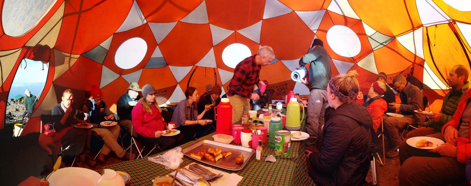
- The Food - I've put a bunch of pics of our food below. It was hot, healthy, tasty, and plentiful! We ate a lot and I was never hungry, but I still lost a few pounds. There was a plethora of fruits and vegetables, with meat and starch every day. No freeze-dried backpacking food, either - all very fresh and just wonderful.
- Medicines - We got an armful of shots before the trek - hepatitis, flu, and tetanus; plus pills for typhoid. On the trek, we took altitude pills, and malaria pills after summitting to prepare for our lower elevation safari adventures. Just in case, we had ultra-strength and regular strength diarrhea pills, acetaminophen, and ibuprofen - I didn't use any of them. I did take a daily multivitamin each day.
- Physical Concerns - The trek went great with no leg pains or injuries. I, along with 6 others, had blurry eye problems on the summit day, but it went away. Breathing in dust every day made for a some dirty nostrils, and the dry air gave me a nosebleed once.
- Human Waste - In all my research and reading, the problem of human waste and toilets on Kili came up over and over. I was expecting to tip toe around poop piles all the way up the mountain. What we encountered was much different. Oh, there were human waste problems along the trail, with toilet paper flowers dotting the landscape, but it was much less than I imagined.
Every camp had outhouses with no seats - our group called them Squatty Potties. Some were in better shape than others, but they all smelled pretty bad inside. Our large group paid extra to have 3 portable toilets lugged along with the rest of our camp gear so we could sit in clean, private comfort.
These toilets were wonderful but did make more work for some porters. All our waste 'flushed' into a small holding tank which a porter would disengage, slosh around, and carry to a permanent squatty potty to dump, bring it back, and set up.
In a small effort to be less of a burden, I used the squatty potties to pee always, and used our toilets only when necessary. I'm used to squatting in the woods on my long hikes, anyway. - Trash - A bigger, and more easily solved, problem was trash along the trail. I'll never understand how a person can carry a 4 ounce candy bar for miles but can't keep carrying the .2 ounce wrapper after eating the bar. With our lethargic pace, I had plenty of time to pick up bits and build a collection in a pack pocket. At each camp, I dumped the trash in a common bag outside the Thunder Dome. It's an easy way to help a little.
Finally, here are a few miscellaneous suggestions to consider that might make your trek more enjoyable:
- Wake before the sun at least a couple times to see the amazing stars and watch the day unfold.
- Take something special for your summit photo. I took an Ultimate Disc to play catch with, but the intense wind ruined that idea. Instead, I had a stick that I had spent the week whittling in our camps (pic below).
- When hiking, put room between you and the person ahead of you if you aren't conversing, so you aren't walking nose to butt. It lets you look around more, and feel free to stop to gaze and take pictures.
- Talk to your guides, cooks, and porters to learn about their lives, hopes, and dreams. Some of our guides were studying computers, engineering, and medicine - their guiding income was helping to pay for that.
- Learn Swahili words, and practice them. Jambo, Pole Pole, Wazungu, ... there are some fun sounding words.
- If you're going to use gaiters, get some Dirty Girl gaiters instead of knee-high snow gaiters - they are very light and keep the debris out of your shoes.
- Bring a cribbage board, or at least cards, for afternoon entertainment.
- Take photos of any glaciers you see since they'll not be there much longer.
- Lots of hours of hiking means lots of opportunity for jokes, riddles, and stories. Having a couple ready each day might make the hike more interesting for others in your group. I told this one and at least got a courtesy chuckle.
When you start planning your trip to Kilimanjaro or Tanzania, contact Tanzania Choice Safaris and see what they offer. They did a super job for our large group.



04/29/2019
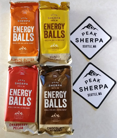
Energy Balls are bite size trail snacks packaged in resealable bags. They aren't your typical granola bar, or power bar, or whatever bar. They contain a nice mix of protein, fats, and carbs with some electrolytes thrown in. These are great for keeping a little energy in the tank throughout the day!
Specs: There are four flavors - Chocolate Almond, Almond Butter Chocolate Chip, Mango Coconut, and Cranberry Pecan. Each package contains 8 balls with about 260 calories total, and weighing 60 grams. The main ingredients are brown rice syrup, tapioca syrup, egg whites, and tsampa (Tsampa is a barley flour). The package is resealable. Costs about $3.
Review
Peak Sherpa sent me a sample pack of their four flavors to try out. I took them out on my morning hikes this past week, walking 26 miles over 3 days. I woke up, drank some water, and then took water and Energy Balls with me on my hike. I wanted to see how well the snacks would keep me going.
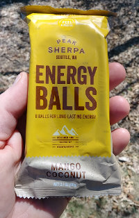
All four flavors tasted pretty darn good, but the Chocolate Almond seems a bit bland and just chocolatey. My favorite is the Mango Coconut because of taste and texture. The fruit and coconut tastes combined well with the almond butter base. Running a close second is Cranberry Pecan which had a maple taste to me even though there's no maple in it - I guess the pecans caused that. Anyway, the snacks tasted very good.
Having individual bite-sized balls makes it easy to just take a piece or share with a friend. A single bar with stamped creases might take up a bit less space and still be easy to divide.
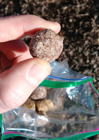

The packaging is fine, but the resealable feature just means a bit more plastic is used to make it more convenient. After my first day of hiking, I just dumped all the Energy Balls into a resealable zip-loc bag to reduce weight and stop the crinkly package noise, and still have the snacks sealed. Over three days, the balls didn't glump together and it was fun reaching in without looking to get a random flavor.
I ate a 35 calorie ball followed by a drink of water about every mile or so the first day. This was about 1/4 of the calories I was expending to hike, but it kept something in my stomach. I didn't feel any hunger for the 2.5 hours I hiked 10 miles.
On the next two days, I just popped a snack whenever I wanted. I wound up eating fewer but still didn't have any hunger.
Value:
On a pure calorie per dollar basis, at $3 for 260 calories, they are over $1.00/100cal (peanut butter is about $.08/100cal). But, at 120cal/ounce, they are pretty good for energy versus weight. The mix of nutrients makes them a great supplemental snack to add variety on a multi-day trek.

Wrap-Up:
I can recommend Peak Sherpa Energy Balls as a supplemental hiking snack, providing great taste and energy to keep you strong while hiking. They give you small boosts throughout the day to keep your motor powered and your body moving down the trail.
By integrating more protein and less sugar, using organic ingredients, and mixing interesting tastes, Peak Sherpa has created a very good trail snack. Besides that, Peak Sherpa donates 2% of their annual revenue to nonprofits like The Juniper Fund and The American Himalayan Foundation.
Hike On
Posted: 04/29/2019
07/19/2019
Posted: 07/19/2019
07/21/2019
I finished hiking for today. You can check out my current location on the map and I'll post about my day when I am in coverage.
Posted: 07/21/2019
07/22/2019

I finished hiking for today. You can check out my current location on the map and I'll post about my day when I am in coverage.
Posted: 07/22/2019
07/24/2019

I finished hiking for today. You can check out my current location on the map and I'll post about my day when I am in coverage.
Posted: 07/24/2019
07/25/2019

I finished hiking for today. You can check out my current location on the map and I'll post about my day when I am in coverage.
Posted: 07/25/2019
07/26/2019

I finished hiking for today. You can check out my current location on the map and I'll post about my day when I am in coverage.
Posted: 07/26/2019
08/01/2019
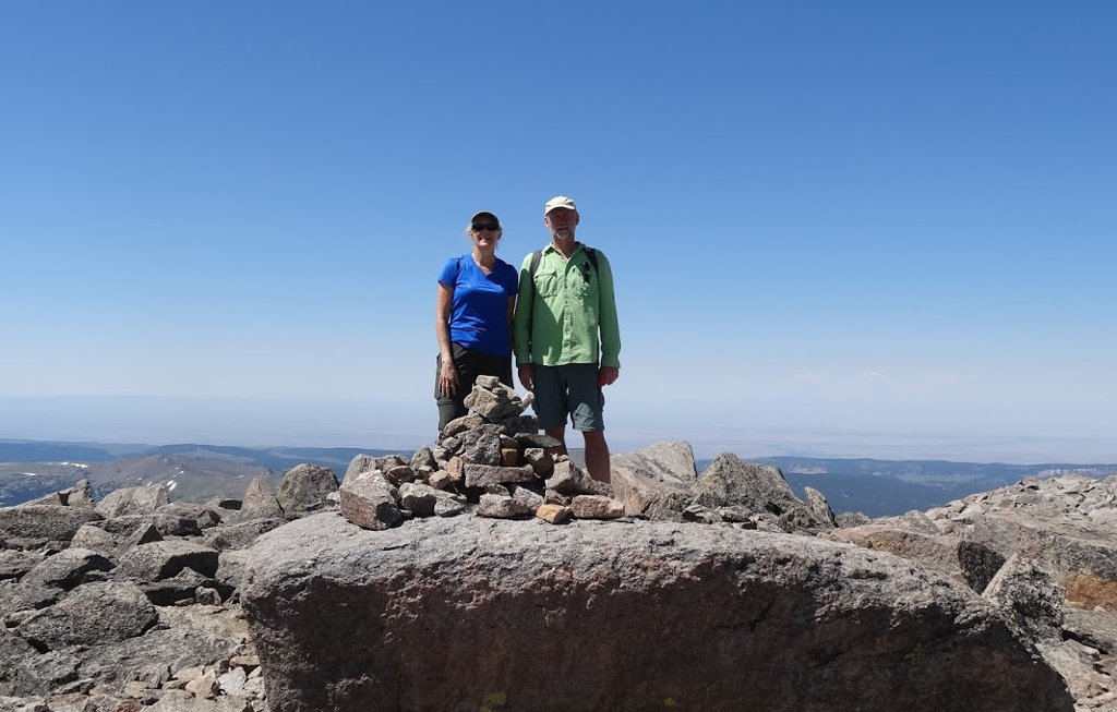

From the flat midwest, the Bighorn mountain range in Wyoming has the closest mountains that rise above tree line, providing challenging climbs and expansive views. Because of that, most people you encounter in the Cloud Peak Wilderness are from Minnesota or Wisconsin. I've led around a dozen groups on treks through these mountains and every trip has been a great experience. Weather really sets the tone for each adventure, with sunny skies or dreary rain drastically influencing the fun factor of each trip.
This past week, we had 30 participants from our church explore the mountains. We broke into 3 groups with each group choosing a separate route. Our group did not see the others for the 5 full days we were in the wilderness. By separating, we helped to minimize our impact on the environment and followed the rules in place for the area.
If you are entertaining the idea of trying a backpacking trip in the Cloud Peak Wilderness, I hope this journal of our trip will provide some helpful information. Feel free to ask me questions about gear, food, preparation, or concerns and I'll do my best to offer useful advice.
Map of our 'Arrowhead Route'
The red line is our route with green tents where we camped. You can zoom in on any part you want, or click the box icon in the upper-right to make it fullpage.
Pre-Trip
To get in shape for this long hike, I took advantage of a local park with hills. We (my wife and I) put on our packs and hiked a loop of about 3 miles that had us either going up or down hill most of the distance. We did this 3 times a week for a month before the trip. Most days when we didn't do this hike, I walked 6 miles in the morning on flat trails with no pack. This kept our legs in shape since our Mt. Kilimanjaro trek a few months ago.
As a group leader, I was responsible for distributing our group gear amongst the participants. To do this, I needed an idea of who was the strongest and balance the weights so our entire group could move along without a weaker hiker slowing everyone down. That is difficult if you've not hiked with your crew, so it's very important to have some practice hikes where you can evaluate the abilities of each person.
The church has a good collection of gear, but it is not extremely lightweight, and the food we take needs to appeal to the majority so it is heavier than what I tend to carry on my long treks. We had five dinner meals, each weighing 6 to 8 pounds, so each adult male got one to carry. I carried the last meal and the 6+ pound cooking kit so I knew that no one would have to carry more than my 13+ pounds of crew gear. Other crew gear includes: toilet kits, water filters, first aid kit, stoves and fuel, and lunch food.
Each person carried their own breakfast (oatmeal, cocoa, granola bars) and snacks (trail mix, candy bars, jerky, ...) but lunch was a shared large jar of Nutella, peanut butter, and summer sausage so someone had to carry those items. I explained to those people that they needed to encourage others to eat their item for lunch which would help to lighten their own load.
Besides crew gear, each person carried their own clothes, water, and sleeping items. Some (especially the newest folks) brought extras, such as chairs, extra shirts, many underwear, and other items that add weight and take space. As it was, I could not fit my heavy load into my DIY lightweight pack and had to revert back to my huge and heavy Jansport pack. It was ok since we were hiking few miles and a leisurely pace and it's a comfortable pack.
Day 0


Everyone met at church at 6am on Saturday, July 20. Photos, prayers, hugs, and then we piled into the three rental vans for a long day of driving west.
Our pastor (who has done this trip over 30 times) drove his truck pulling a camper trailer so his family can extend the adventure when we all head home. About 2 hours into our drive, a huge, dark cloudbank pushed towards us from the northwest as we were driving southwest. The rain started and then the wind. As it changed from some drops to a downpour to a raging storm, I wondered how much force it takes to break a passenger side window.
We were driving about 30 mph and limping along to a big truck stop about 5 miles down the road when we saw headlights shining toward us on the righthand shoulder. It was the pastor's truck facing the wrong way, so we pulled over past it and stopped. Not me, but a more courageous fellow, hopped out and ran back to see what's going on. A few minutes later, he returned no less wet than if he had just climbed out of a swimming pool. We continued on to the truck stop while he told us what he found out.
The camper was caught by the wind and flipped over. This lifted the back of the truck off the ground and the wind spun the entire mess around 180 degrees. Thinking quickly, the pastor put it in 4-wheel drive to pull out of the way of traffic at the same time the wind caught camper and flipped it back upright. Very scary ordeal, but no injuries and damage only to the camper and hitch.
When we reached the truckstop, all of their electricity was out so we could get no gas. It was dark as night so people going in to use the bathroom all had cellphone flashlights on. Once all 4 vehicles arrived, phone calls were made, people settled down, and we drove to the next gas station to fill up.
As it turns out, that is the only thing that goes wrong all week. After this, the trip is practically perfect in every way!
The drive across South Dakota and into Wyoming was uninspiring. Of course, there are the usual places to pass - Mitchell, Chamberlain, 1880 Town, Wall Drug, coal mine - but we drove on to Buffalo, WY to camp. I do have a tradition when making this drive with a group - I say I'll buy ice cream for the first person to spy Devil's Tower and for the first to spy an antelope. It's something to do.
In Buffalo, we stayed at the Big Horn Mountains Campground hosted by Paul & Bev. They are a wonderful couple that always make us feel welcome and have stories upon stories to share. They are limiting their campground business though, so you might try the KOA or other campgrounds or hotels in town.
Day 1
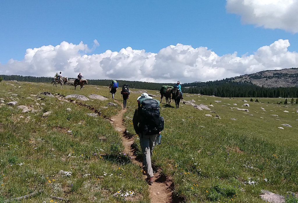

Hikers can enter the Cloud Peak area from east, south, west, or north and each of our three groups had a separate entry point. One would go in the east and come out the south, the other would enter and exit the south, and we would do a loop in and out the west. That meant we had an extra 2 hour drive before we could start hiking. I was very happy that everyone was up before 7am. After a could sugar cereal breakfast at the campground, we loaded up and headed to the trailhead.
Our entry point was Battle Park trailhead which is a popular horse area. A 15 mile bumpy dirt road kept us all awake that last 45 minutes. We arrived, used the outhouse, filled our bellies and bottles with free water from a pump, and hit the trail by 10:30am - I was hoping for noon at the earliest so I was extremely pleased with a gentle day ahead of us. I've hiked this part before and it's a nice introduction to the week ahead. With full water bottles and empty bowels, we saved on filtering water and digging a few extra catholes - I never pass up a toilet when out on a long hike.
We filled out a free but mandatory backpacking permit - forgetting this might cost you $200 - and started walking out on the extremely well-used trail into the woods. A bright, cool, wonderful day was a great way to enter the wilderness.
As expected, we took many short breaks as people adjusted their packs, got used to the walking, and finally started to realize what they had gotten themselves into. But, it's too late to turn back now.
We had our lunch of summer sausage, tortillas, nutella, and peanut butter on a big rock in a wide open meadow with great views all around, especially up into the snow-covered mountains to the east. We met our first group of horse and watched another group on a trail off in the distance. As much as possible, I sit, stand, and rest on rocks rather than grass out here. We also use them as tables and cooking areas since it's much easier to find dropped items and to clean up spills.
After lunch, we headed southeast across a large meadow and into woods towards Lily Lake. We could have taken a shortcut trail earlier and cut off about a mile of hiking, but we had such a short hike and a lot of time, I decided to let today's hike be a bit longer. Even so, it was less than 4 miles. To find the Lily Lake Cutoff trail, we had to cross open country. So, rather than a single-file line, we spread out, each of us taking our own route until we found the new trail. This minimizes the impact to any one part of the meadow. Once on the trail, we stayed on it to the lake.
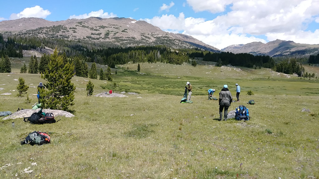

Circling around the west and south sides of the lake, we located a relatively flat, open area that was 225 feet from the lake (I counted the steps). The views of the lake, mountains, and clear blue sky were wonderful, but we had a little work to do before relaxing the rest of the afternoon and evening. Starting a routine, I pointed out where our cook area would be and where to set the toilet kits. Each person is responsible for unloading their group gear and putting it in the appropriate place, then setting up their tent wherever they want. Once that's done, we need water and a plan for dinner.
We made a simple plan for cooking and clean up. Whoever carried in the dinner meal would cook it with a partner. Whoever cooked last night would clean dishes this night. The person that carried in a meal gets to carry out the garbage of that meal. This means whoever carries in meal #1 has a lighter pack all week. It also means the meal carrier has incentive to encourage everyone to eat all the food so he has no heavy left-overs to carry out. This night's meal was Pesto Pasta with dehydrated chicken. Since I was carrying the last night's meal, I got to do dishes tonight.
As a wrap-up each evening, I decided to lay out a general plan for the next day of how far we have to hike, when we should get moving, and any particulars to expect along the way. We have short miles so I'm letting the group decide when to get up and hit the trail, as long as it isn't silly late. They chose to be on trail by 9am tomorrow - we'll see. The weather all day was clear, cool, and breezy. There were plenty of mosquitoes but we were all protected with either repellent or mesh covering.
Day 2
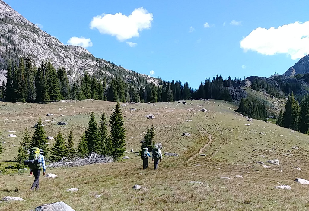

With sunrise coming at 5:45am and sunset holding off until 8:45pm, the days in the mountains are light for nearly 16 hours this time of year. A chilly morning was quickly warmed once the sun broke over the mountain range. We had breakfast, packed, and waited for a couple sleepy-heads as the sun dried condensation off our tents. We watched a couple dayhikers head up the trail and one group of six girls backpack out before we headed out - at 9:05 - right on time. Today was our longest mile day and is mostly uphill, but still should not be very strenuous. This stretch of trail was the only piece I've not hiked before so I was excited for something new.
The well-defined trail followed the Middle Paint Rock Creek along the southern slope of Elk Mountain, up over a pass into the Mistymoon high-use area. We had plenty of water so we hiked about 3 hours, being passed by a horse group, taking many short breaks, and having a couple stream crossings that we just hopped or stepped over. Near the top of the pass, we stopped for an hour for lunch at a small snow-fed lake with a big snowbank at the end of it. We filtered more water and relaxed as another horse group rode past. It's easy to enjoy the trip when there's really no hurry and the weather continues to be stellar.
After lunch, we crested the pass at 10,600 feet and dropped down near Mistymoon lake where I was surprised to see no tents nor hikers. We passed right through this 1/2 mile stretch because it now has special regulations - you need to pack out solid human waste. We no longer camp here since it is overused. Right now, this is only the Mistymoon drainage area but may be expanded as human recreation pressure increases.
We met two more groups of horse, but still no other hikers, as we climbed out last small rise for the day that opened into the Paint Rock Creek drainage at the base of Cloud Peak. Across the valley, I could see a few people standing in our hoped for camp spot. As we hiked closer, they began setting up tents - maybe because they saw us, maybe just a coincidence. Whatever, we needed to find a different spot.
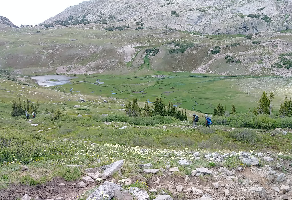

Most of the land here is covered with cantaloupe or watermelon sized rocks so usable tent spots take effort to find. As our group waited and rested, two of us scouted up the trail for spots. As it turns out, we found a beautiful place - much nicer than the original - with a great view of the valley and of Cloud Peak, and it would make tomorrow's climb about an hour shorter. The only problem was we had to cross a large creek and climb a short, steep trail. The water crossing and short climb took another 15 minutes and we were at our new home for the next two nights. Tomorrow would either be a climb to the Cloud Peak summit or resting around camp, whatever individuals wanted to do.
The only concern I have camping this high, at 10,400 feet, is exposure to lightning. It's just a fear I have, having been out in unprotected situations many times. There are high mountains around and a knob with trees on top close by, but tenting on open ground always concerns me.
This day was yet another nice sunny day with cool breeze, but thick clouds have built to the east and over the mountain. They could drift over us or dissipate, you never know. As long as we're moving, the mosquitoes aren't bad, but when the wind stops and we're sitting or standing around, they become a nuisance. Our mesh layer does a wonderful job of protecting us and I've only gotten a couple bites on my ankles and hands - my fault.
Dinner was Red Beans & Rice with dehydrated beef chunks. I've not had these dehydrated meats before but they are really pretty good and add more substance to the meal. We tend to carry way too much food on this trek. I've not even touched my breakfasts yet and have eaten just a few snacks. Next time, I'll leave even more at home.
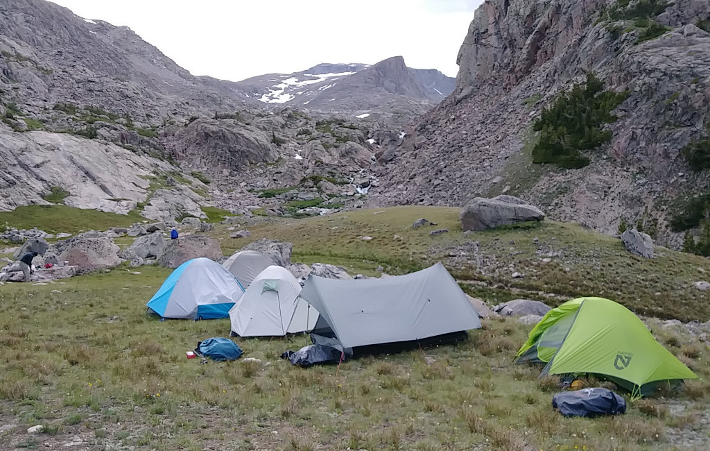

Most of the tents in our group blend in well with the grey rocks. I especially like our Bear Paw Wilderness Designs tarp and bug nest - the a-frame shaped one. It's the lightest, smallest shelter here and has worked well for two people for the past four years. So far, I've spent nearly 100 nights in it and it is still in great shape.
Day 3
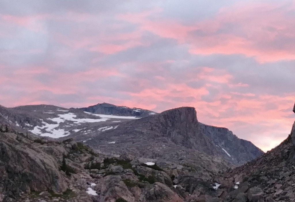

Last night, with the dark clouds, we decided to see what the weather looked like in the morning and use that to base our climbing decision. This beautiful sunrise made the decision very easy! Six of our group of ten got up at 5:20am, saw this, and got busy. I heated water while the others got their dayhike gear together. After a quick oatmeal and cocoa breakfast, filling water bottles, and securing our gear left at camp, we were heading upwards by 6:05am.
The few clouds burned off quickly but we got to hike in shade for the first 45 minutes or so. After that, the warm sun convinced us to shed layers quickly as we continued onward and upward. I've been up the mountain at least six times but the last was a few years ago. I think the mountain has changed since then.
This year has much more snow than any other. We avoided most of it because a step onto snow is often a step through snow, but a few spots were unavoidable. I did step through once and cracked my ankle on a hidden rock. The rocks are larger and the climb more rugged than I recall. With extra snow, I believe some of the preferred route was hidden, but we continued on. We were blessed with warm, dry rocks so footing was nice and safe. But, up here, just one misstep can result in a very serious situation.
As we climbed through 11,000 and 12,000 feet, a few of us experienced mild headaches but one climber started feeling the effects of altitude. We stayed hydrated, some took some acetaminophen or ibuprofen, snacked, slowed our pace, and kept going. At just above 12,000 feet, we were running low on water and were in the area I call the 'wheelchair ramp' - it appears from below as a nice, easy, gradual, bowl-shaped area. Here, we found a trickle of water and took a 20-minute break for snacks and filtering water. This is about the last place to find water up the mountain so skipping it can be troublesome.
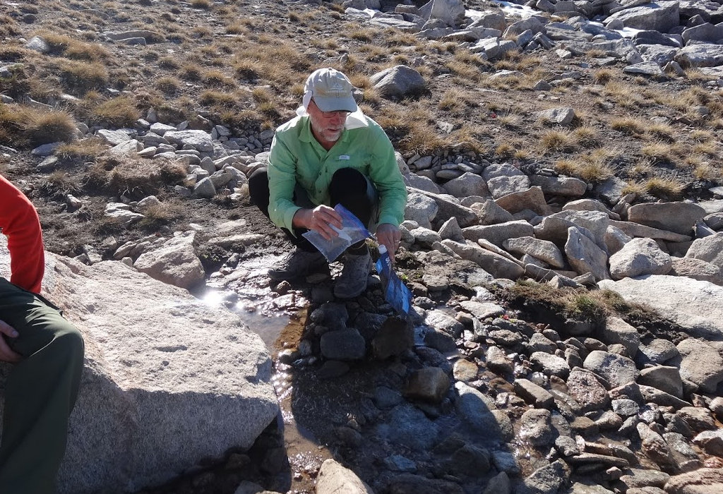

Our water filters worked great the entire week. We use Sawyer Squeeze filters which is what I've been using on all my long hikes since 2012. I actually have, and use, the same filter for the past 7 years and it doesn't fail. In camp, we hang the filters and let gravity force water through them slowly but out on the trail, we use the squeeze bags to go quickly. I use a zip-loc baggie to retrieve water from the smallest of trickles and then fill the dirty water bag from that. We backflush the filters with a little clean water at the end of each day to clear them of contaminants and ensure they are ready tomorrow.
After hopping over boulders and scrambling over snow, we reached the summit around 11:30am - a 5.5 hour climb. We were passed on the way up by one hiker who was doing the 24 mile round-trip from the West Tensleep trailhead to the summit in one day. HYOH!
While enjoying the views, a couple arrived and took pics of our entire gang. We worked up the courage to look over the vertical 1,200 foot drop straight down to Glacier Lake on the east face and even saw snow-capped mountains off to the southwest and west. Doing some research when I got home, it turns out these are the Wind River Range with Wyoming's high point of Gannet Peak to the southwest, and Yellowstone Nat'l Park to the west. This was the clearest, brightest day I've ever had on the summit. We could see mountains that were 140+ miles away!
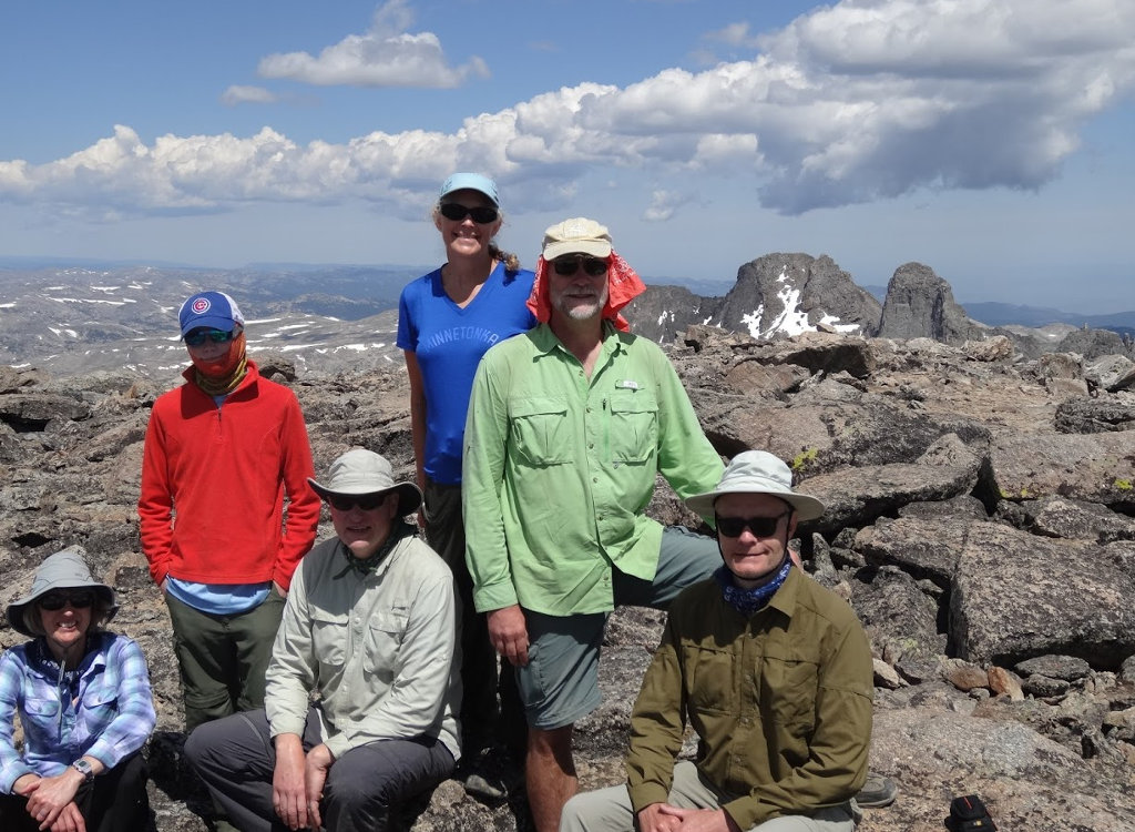

Clouds were beginning to build to the north and roll in, as they very often do, so we headed down around noon. There were other groups still going up, most notably a scout group that was moving very slowly and had a long way to go into the darkening clouds. As we descended and the clouds thickened, they continued to inch upward. We reached camp at 4:15pm and there was rain and lightning up on the mountain by then. I expect that scouts had an exciting hike down in the weather and especially on wet, slippery rocks.
During our dinner of Spaghetti and dehydrated ground beef, we got a couple raindrops and hailstones, but nothing big. The weather was threatening but stayed to the east, so yet another wonderful day! And, as they say, 'It's all downhill from here.'
Day 4
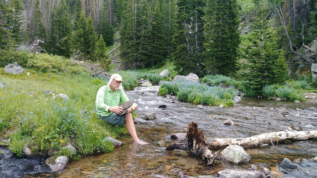

Right off the bat this morning, we needed to cross the stream we crossed to reach our campsite. The four that did not climb Cloud Peak yesterday did a shorter day hike. While doing that, they felt that they found a way to cross the creek lower down on some rocks so we could skip a significant hill climb and drop. Looking for more adventure, and being in no hurry today, we had them lead us. It was a fun off-trail excursion, but ultimately ended at a rockfall and we did have to do a wet crossing of the stream. It was the first of three for the day. But, it was a good idea and did save us a hill climb. Looking over the map and google earth at home, I believe we could have been more successful had we ventured a bit farther north - maybe I'll try that next time.
Just as we crossed the stream, our first rain started. Folks put on their raingear, even me after waiting and hoping it would stop. Less than five minutes later, the rain stopped and that was the only time we needed rain protection the entire week. But, the raingear was very helpful in protecting from mosquitoes and keeping warm in the evenings.
Our hike was all downhill today, to the head of Lake Solitude. This campsite is heavily used by horse traffic but we saw only three hikers all day, and they were going the opposite direction. We got to camp around 12:30 having complete our easy, leisurely stroll down the valley between beautiful, steep mountain cliffs. The clouds held on furtively until about 3pm when they gave up and dissolved to another gorgeous afternoon. Today and tomorrow are our fishing days since we'll be by good water and three of us purchased licenses. So, we fished or relaxed all afternoon, had a nice Chili with hamburger dinner, and fished some more. The spinner fishermen caught more than flyfishing, but we all had fun and caught and released a bunch of brook trout and lake trout.
Day 5
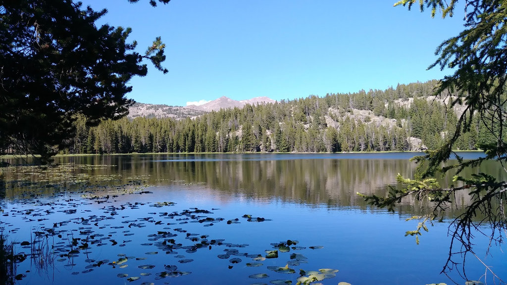

Another no-hurry day with a short hike to Grace Lake for our last night. I was up and fishing by 6:30 and then the usual breakfast time and on trail by 9:30. The only challenge of the day was a 250-foot climb from this valley to the next where we found Grace Lake.
The trail is pounded down from horses so it's very easy to follow and we stayed on it out of the official wilderness and around Grace Lake to a highly-used campsite. We arrived and had camp all set up before 1pm, so of course we went fishing. Grace Lake has some massive brook trout and we caught our share, releasing them all back since we still have tons of food.
Our final dinner, that I lugged over the mountains for the past week, was Mac & Cheese with tuna. I didn't eat any because I don't like M&C, but everyone else took care of it with no problem.
After a few morning clouds, this was yet another clear, refreshing day in the mountains. Well, we were all the way down at 9355 feet so I guess we were not really that far up, but it wa still an awesome day. Since this campsite is out of the official wilderness, we could have a campfire, but no one was really interested and we headed to bed at our typical 9ish time. I asked the younger backpackers when they'd like to get going in the morning and was surprised when they said 9am - sounds great to me!
Day 6
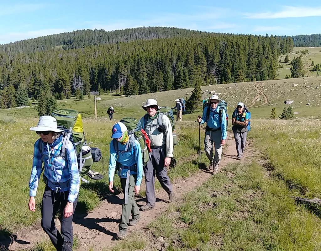

Today's hike started with a rugged 500-foot climb over the shoulder of Elk Mountain followed by a long, gradual downhill to the trailhead. We got an early start, took our time and reached the Battle Park trailhead before 10:30am to see our waiting van right where we left it. A quick rinse under the ice cold pump water and many stops in the outhouse and we packed our gear and drove away.
The bumpy ride back to Buffalo went quickly, but we were not the first group back. Another group had arrived, taken showers, and headed off to lunch - so we did the same. The shower felt great and we headed to Papa Bino's mexican diner where we were treated to huge servings in a modest house. Very fun, especially being waited on by a real-life Wyoming cowboy named Trenton who even showed us his 2018 championship buckle and big scar on his shoulder from a steer mishap - and he's too young to serve alcohol.
After lunch, we all wandered on our own through downtown Buffalo for a few hours because it's more interesting than sitting at the campground. The Sports Lure is a big outdoors store where you can spend lots of time and there are other small shops to weave in and out of. Back at the campground, we had a big pizza dinner, short recap from each trek crew, and then to bed to rest up for the 12 hour drive home bright and early tomorrow.
Hike On!
Posted: 08/01/2019
Older Posts Newer Posts
Find more Hiking Resources at www.HikingDude.com


Follow Me
Recent Comments