
Camino de Costa Rica 2023 Journal
Go to main Camino de Costa Rica Hiking Info page.
Read the Journal of Second Week on the trail.
Read some Camino Advice.
Click photos below to view a larger version.
Before the pandemic began, my wife and I heard about a new hiking route across Costa Rica from the Caribbean Sea to the Pacific Ocean. The route was about 170 miles and guided hiking groups would complete it in about two weeks.
It sounded like a new adventure so we decided to do it, but we had to postpone our trek three times due to travel restrictions. Finally, we completed the supported thru-hike from January 15 to January 28, 2023 and it was a terrific trip. Having a guide service arrange all the food and lodging made for a pretty luxurious excursion, but we still had to put in the miles over steep, exotic terrain.
The two of us joined seven other hikers and two guides for a group of eleven walking from coast to coast. Following is my hike report. To see a track of our route, you can visit my Trail Map page. I'd be happy to field questions you have about this trek - your experience will certainly be different than ours, but hopefully this info will help you prepare.
(Click for Larger View)
The hiking route crosses Costa Rica on foot, leaving the Caribbean coast from Barra de Parismina and reaching the Pacific coast in the town of Quepos. The route was designed to encourage rural tourism in areas away from traditional tourist areas and to provide a unique opportunity for visitors to get to know rural communities.
Hikers enjoy the great biodiversity of nature while walking over mountains, through forests, and along remote roads and pathways, sharing with the local inhabitants along the trail.
We are anticipating this long hike with a little trepidation. It's the dry season in Costa Rica now, but weather craziness has forecast about 6 inches of rain while we're there - about 1/2 inch per day. But, it's a warm rain with temps into the 80s. So, we're prepared for two weeks of moisture which will certainly increase the challenge.
We decided to fly in to San Jose (Costa Rica's capitol) a day early so we could explore a bit. Our flight from MSP to JFK, and then the connection to San Jose, was uneventful, even though it was on Friday the 13th. It was just 12 hours of lost time, but with the movies and WiFi on planes now, it goes much quicker. Since Costa Rica is in our same time zone, and actually a bit farther east, we have no time issues.
We arrived at night, met the owner of our guide company, and he took us to our hotel. The rest of the gang will be arriving tomorrow and then we all head to the trail the next morning. The owner of ViaLig Journeys, Fabian, is a great guy. He is a school teacher who just recently started this business and is passionately providing employment to wonderful young guides, additional income to local residents, a complete service to foreign visitors.

There are a handful of companies that can assist you with your Costa Rica hike and I expect they are all capable. Since I typically plan and execute my long hikes from start to finish, I'm pretty critical of paying money to have someone else do what I can do myself. But, when trying to come up with feedback for our guide to improve their service, I was stumped. Every aspect of their service was valuable, considerate, and economical. The only bits I could come up with are included in the "Advice" section at the end of this page.
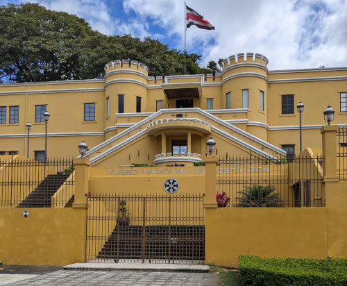
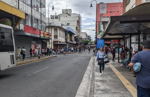
After a nice rest overnight at the Hotel Aeropuerto, Fabian gave us and two others in our group from Seattle, John and Matthew, a ride into downtown San Jose for a day on our own. We walked through the city to the National Museum of Costa Rica where we spent a few hours learning A LOT about Costa Rica's history. I'd highly recommend the time spent there before hiking across the country as a nice way to get a feel for how the country came to be what it currently is. For example, Costa Rica has no military since 1948.
We also got a couple hundred dollars worth of local currency - Costa Rica's bills are beautiful!
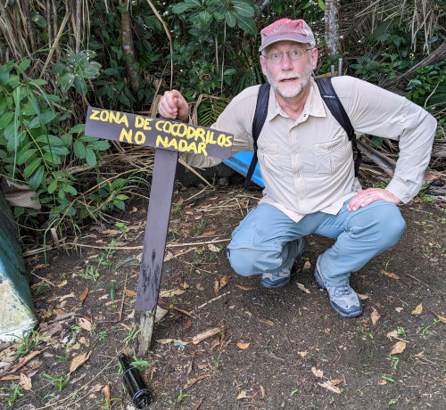
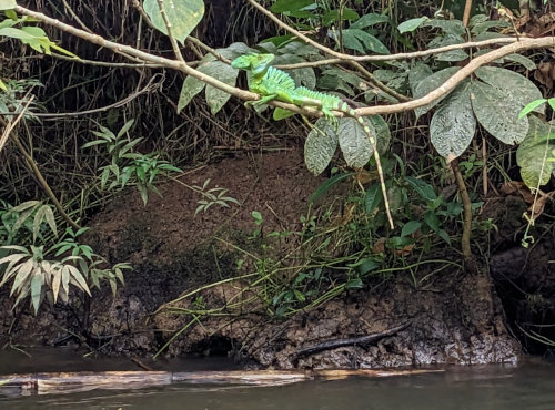
A 4 hour drive from San Jose to our start point was followed by a 45 minute boat ride down canal and river to a nature refuge on the Caribbean Sea. On the ride, we saw a green basilisk, a crocodile, lots of monkeys, a heron, and many other birds. Pretty fun to have a herd/gang/troop? of monkeys swinging through the trees over your head.
Our two guides, Samuel and Stephen, are in charge and we met Mike to guide us these first 6km through the refuge. He works at the refuge and it seems his main job is to make sure we don't get killed by snakes. Sorry I didn't get a photo of his big machete, but nearly everyone here carries one.
We walked north through jungle paralleling the coast just on the other side of some sand dunes and could hear waves breaking the entire way. A very wide nice flat trail was gentle for walking, and we saw a tiny yellow viper, white eyelash viper, and dead snake. Also, a sloth, monkeys, ants, a few butterflies, and a big frog. Plenty of wildlife on our first day!
Actually, our guides saw these things and pointed them out to us. It's amazing how they can pick out interesting things in the thick foliage. It makes me wonder just how much we obliviously walk right past.
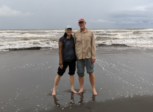
Near the end of our walk, we crossed over to the beach at a research station, and the sea was looking very angry today. We stepped into the ocean to start our hike west. The water was very warm. A very short walk to a dock on the Rio Madre de Dios river followed by a loud whistle resulted in a quick boat ride across to our lodge for the night. It just started drizzling while crossing.
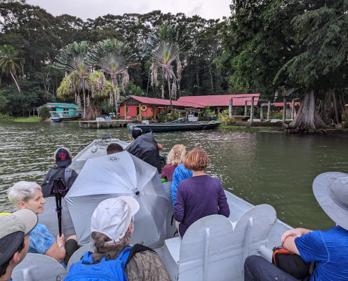
This lodge is a small place with 3 or 4 cabins so the women are in one and the men in the other - and, since we're the only couple, the two of us get the third. Rustic with only screen windows, but clean and nice with cold running water. Julio Knight is the fellow that shuttled us up and down the river, and owns this lodge.
It was nice getting a little time to chat with the other 7 people in our group today. It's a wide range of ages, nationalities, experience, and personalities so I'm looking forward to more trail conversations. We have Oregon, Washington, New York, Minnesota, Ontario, and Switzerland represented.
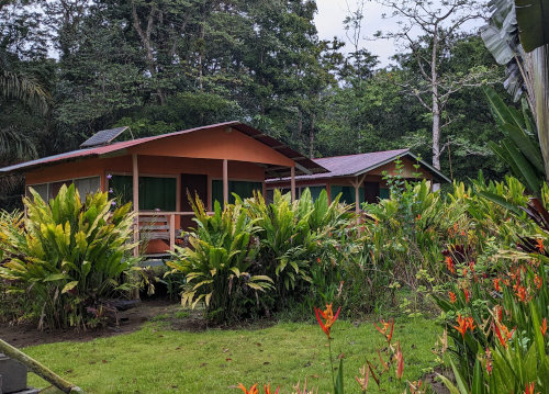
Our hike was only about 2.5 hours at a leisurely pace. Just a nice stroll to see how everyone does, and it looks like a great group. We arrived around 4:45pm and dinner was at 6:30 so we had a little time to get settled. Our bags were waiting for us on the dock, delivered by boat. Dinner was in an open gathering area like picnic shelter and was a sort of Asian stir fry with rice. We sat around chatting for a couple hours, but since it gets dark by about 6, we were in bed to sleep by 9:30 to the buzzing, clicking, rattling sounds of the jungle.
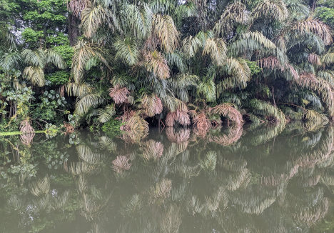
The rain started in earnest in the middle of the night but stopped just as we got ready for breakfast. We woke at 6am to howler monkeys off in the jungle. Had a wonderful 6:30 breakfast and loaded into the boat yet again at around 7:30. A short ride up the river with dense jungle reflecting off the still water, and we were hiking by 8:30.
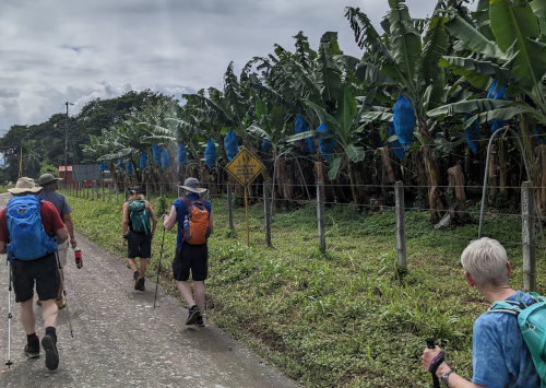
Today's route took us through the coastal flatlands dominated by banana fields with views far ahead of rising mountains.
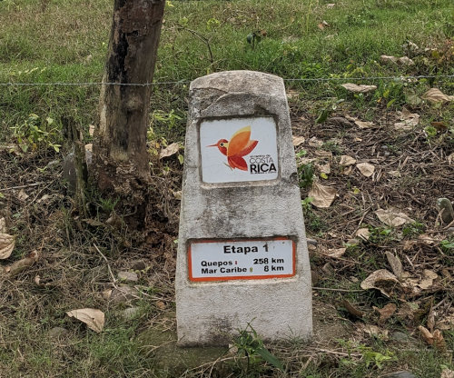
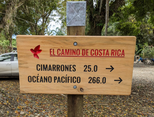
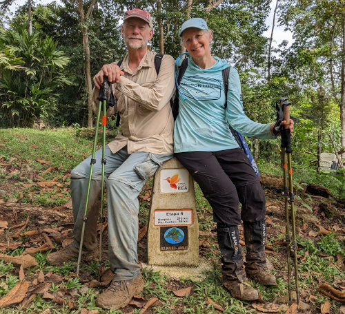
The Camino de Costa Rica is divided into 16 segments - not really sure how they are determined, but there are significant cement markers for every segment. The distance on these markers is 266km rather than the advertised 280km, so it's an easier hike than you expected!
In the afternoon, we entered the first low hill country with fields of pineapple as we rose out of the flat banana lands. The entire ~23km hike was on roadway, mostly gravel and dirt with very little traffic. So, it was another gentle day with no rain, but the heat and humidity were noticeable.
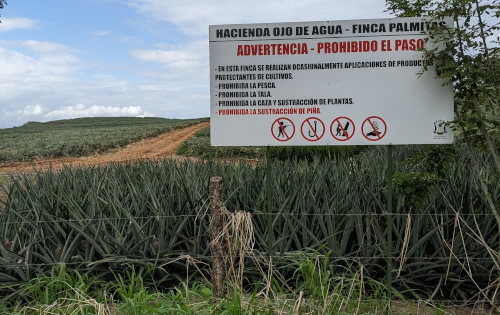
In this pineapple field, it is prohibited to: enter, hunt, fish, log, take plants, and especially take pineapples.
And, "on this farm, applications of crop protection products are occasionally made" -
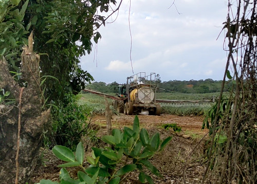
(Click to See Video)
One of our group had their luggage misplaced by the airline and she is handling it quite well. Other than that, it appears we are all doing well.
Our big breakfast before leaving the lodge, and big lunch in a small restaurant by a huge banana plantation in San Carlos de Pacuarite, supplemented with rest breaks every couple hours where a support van with cold drinks from a cooler meets us along the route means we're not losing any of our Minnesota winter weight. I'm getting terribly spoiled for future long hikes.
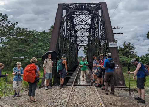
The hike ended at about 3pm at a railroad bridge just before crossing a major roadway. A short van ride to the Hotel Pacuare brought us to our luggage, showers, and air conditioning. This was greatly appreciated after today's muggy walk. Some of us enjoyed a small swimming pool before dinner which was in the hotel's restaurant.
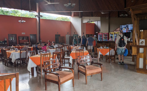
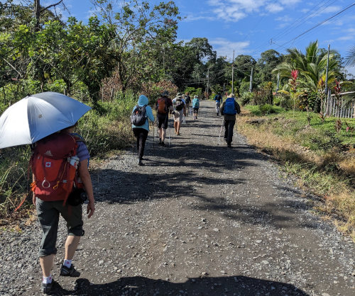
We are definitely out of the flatlands today. A shuttle van dropped us off at the trail after a great breakfast at the hotel, and the trail/road climbed uphill for most of the day. Plenty of blue sky and hot sun and my umbrella was up to the task of keeping me from burning.
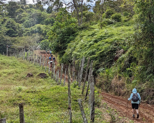
When we ran out of gravel road, we had slick red mud, and finally a trail when the 'road' ended. By 'road', you should think of 4x4 Jeep trail up the side of a mountain. They are often steep, rocky, and rutted even though they are the only route to some small villages.
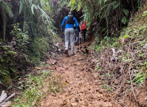
Before setting off on the overgrown trail, everyone put their lower pant legs on because this section has a sharp, cutting grass with barbs that grip and rip. It was a nice change to be walking on single-track trail.
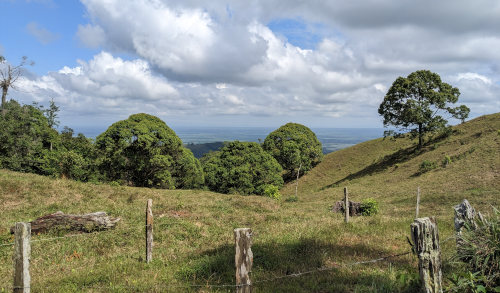
Continuing uphill, the day became warmer and more humid, but gave us some spectacular views of the countryside. We worked hard and sweated a lot! We mostly passed through steep cattle grazing land and rain forest but saw little wildlife. A highlight was seeing a sloth hanging out in a tree right over the trail. My favorite was seeing leafcutter ant highways where thousands of ants carry leaf bits across our path and into the jungle. Evidently, they chew up the leaves and mix with saliva, then eat the fungus that grows from that.
We also saw 4 beautiful bright green parrots, and about a dozen parakeets. The parrots were extremely loud squawking in the trees. The parakeets were flying as a small flock but they were all flying in obvious pairs of mating couples.
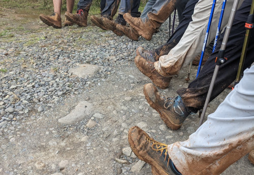
We finally encountered rain at the very end of our day's hike just as we reached our destination at around 2:15, even though our pants and shoes were already plenty muddy. We are 'camping' inside a one room school cafeteria. It is very simple but clean and comfortable. There is a single, cold shower, toilet, and potable water faucets. Two young ladies made us a late lunch of squash soup, and later made a nice dinner. We are in the clouds while the drizzle continues and the temperature has dropped enough that we are wearing our fleeces.
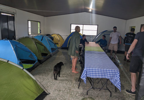
I don't know about you, but I think 4am is a bit early to get up for a hike, but that's what we did this morning. Fortunately, we didn't need to take down camp so we were on the road by 5:10am with our headlamps on and brown bag breakfasts in our packs to eat later on the trail. It lightened up quickly and we met our indigenous NaiRi AwaRi guides, Oswaldo and Alexander, to cross their lands and a nature preserve.
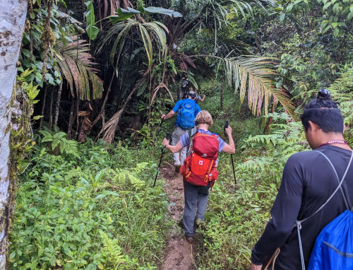
This day was a very strenuous, very exotic experience. We hiked around 12 miles, but there are a few differing estimates in our group. The entire day was on indigenous trails through a lush, wild jungle with steep climbs and descents under a canopy of massive trees with vines hanging to the ground.
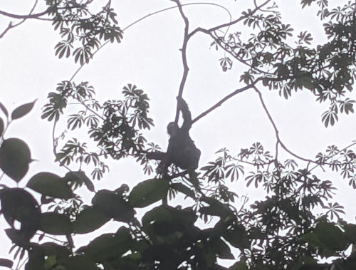
Our guide explained about vines used as ropes to construct huts, nuts as perfume, seeds as spices, and sap as a fire starter. He also shared Spanish words for many things such as mariposa, mapache, and loro - my Spanish vocabulary is pretty much doubling every day. One highlight was watching a sloth in a tree above us.
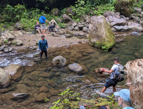
We had three water crossings, the last being a cable car, as we traversed a handful of mountains with around 4000 feet of elevation.
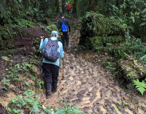
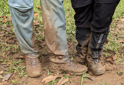
The trail was treacherously muddy with the majority being a steep drop to a river or climb to a ridge top. This is some of the slickest mud I've walked on. The trail definitely gives the West Coast Trail a run for the "most muddiest trail" title.
(See Video)
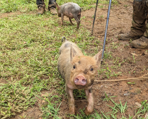
Another highlight was stopping for a snack at an indigenous NaiRi AwaRi farm and befriending a pair of piglets. When we hiked on, these two joined us on the trail for almost a mile, not turning back until we reached the river.
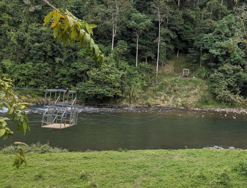
After riding a cable car across the Pacuare River, pulled by our guides on both sides, our hike ended with a 650 foot climb up a steep hillside to a road where our shuttle waited. I pushed hard all the way up to finish with some exertion. A beer and fresh pork sandwich while the rest of our party arrived was a most excellent way to finish this great day.
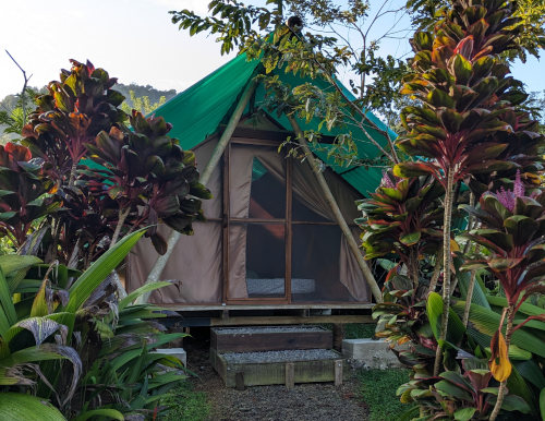
We were shuttled quite a way to El Ceibo for our evening rest. This is a quaint 'glamping' spot with very nice screened tents, nice hot showers, and a wonderful staff. They offered laundry service so most of us paid a bit to clean the mud from the past two days off our pants.
We had a wonderful dinner and a bottle of tequila while we chatted about our day. I love self-supported long distance hiking, but I've discovered that going with a group can be a ton of fun. Fabian, who owns the tour company ViaLig Journeys that we are using, shared an interesting thought with us this evening before dinner. He said that we should be proud of completing this most difficult day hike of our trek, but to realize that the indigenous people here do large portions of it nearly daily just to go to school or to get groceries.
At the end of yesterday's hike, Fabian our tour coordinator, said that today would be much easier. Well, it was shorter at only 17km, but not much easier. Our day started by being woken at 5:20 by a very persistent bird calling for a mate - after about 5 minutes of whooping a return call started and he flew off towards it. Definitely better than an alarm clock.
While having yet another wonderful breakfast, we were treated to many more birds flying around and courting. My favorites were a few big oropendolas being all black with a bright yellow tail. When they did their call, they would flip upside down under their branch and then back up. Very entertaining.
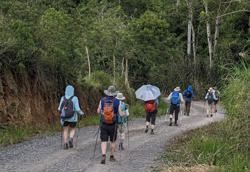
With our freshly washed clothes, we were dropped off to start hiking where we stopped yesterday and we're on the trail at 9:15. By this time, the sun was high in the clear sky and it was warm. Humidity was lower than yesterday but the steep climb to start the day got the sweat flowing just fine.
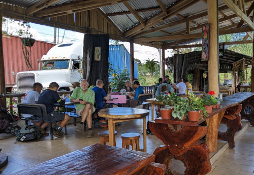
After our first climb over a mountain, through a cattle pasture, and following an old path, the rest of today's hike was on rural dirt roads with one tense mile on a busy paved road with very minimal shoulder. We stopped at a roadside open air restaurant for lunch after only 2 hours due to the heat. The rest was appreciated and the food was good even though I was still working off breakfast. I had Cas juice which is new for me and very tasty - a guava grown mostly in Costa Rica.
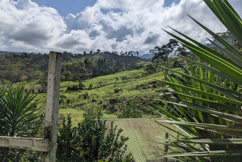
From lunch, we climbed and dropped up and down mountains through villages with nice views over the sun-soaked, green countryside with sugar cane fields until reaching our destination of Pacayitas at about 3:30. This is the home base of Via Lig, our tour company. We enjoyed a fruit drink and rest for an hour in a cool, shaded patio area in their estate.
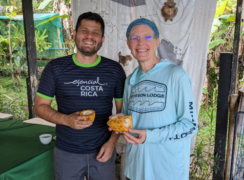
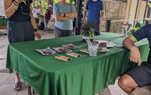
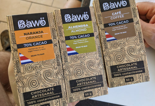
One of our guides (Samuel) runs a craft chocolate company with the rest of his family. It is Bawo Chocolates, on Facebook & Instagram. He shared a cacao fruit with us and then some chocolate samples, and explained the process of creating chocolate. He did a great job, but I found the cacao fruit to be slimy and gross. The 70% cacao chocolate, on the other hand, was wonderful! This is local only and can not be found outside of Costa Rica. So, Samuel arranged for us to purchase a bunch to bring home with us as gifts. And, I got a bag of cocoa nibs to use in my next batch of stout beer.
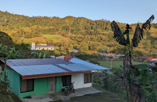
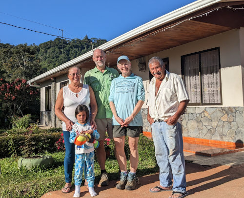
Since Via Lig is a small family business, we have all been farmed out to various relatives and friends to spend the night in their homes tonight. The two of us are at a friend's home with a view of the town over the shallow valley. It has been the best night of the trip so far. They are wonderful, gracious hosts and the Google Translate app has been heavily used to communicate since they speak no English and we are both lacking in Spanish. We took hot showers then visited and had dinner with our hosts, their adult son who speaks fine English, and our two hiking guides (Steven and Samuel).
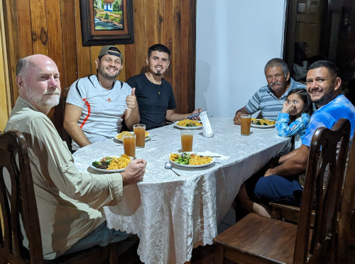
We had 'Frog juice' for dinner - lemon and brown sugar - and a tasty chicken meal.
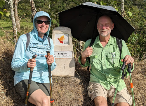
We have now covered about a quarter of the Camino distance and are steadily gaining elevation. The terrain rises from the Caribbean for about 2/3 of the distance and then steeply drops to the Pacific side. I'm sure tomorrow will have more mountains to cross and surprises along the way.
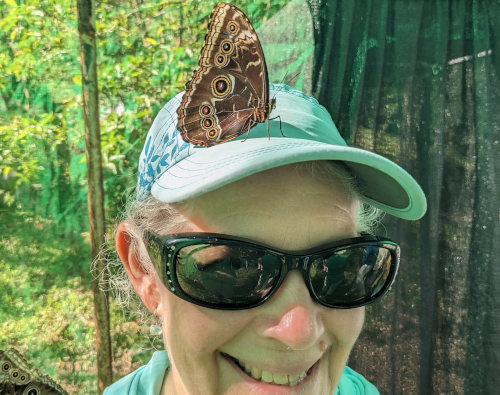
Our hosts last night were Venturo & Elisa. Their son, Diego, and his wife live next door with their 4 year old girl, Isabella. The next house is a daughter named Adrianna. All three houses are simple but nice and very well kept, having been built 40 years ago. This entire town appears to be more well-off than others we've walked through. Like others, this one has a church, school, and of course - a soccer field. Having small crop fields and trees interspersed among the homes is a good example of the typical use of every available space that goes on here.
We were woken this morning by a man walking a loaded donkey past our open window at about 5:15. At the same time, all the birds in the neighborhood began chirping, squawking, and singing. So, it was a good time to get up and explore.
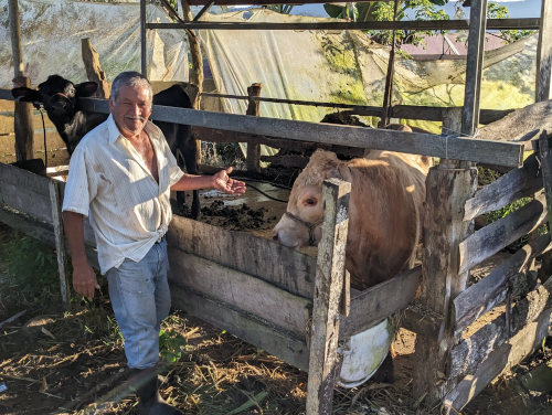
We took a short walk around the village to see and listen to the birds. When we returned, we went with Venturo to feed his cows and see some of his farmland. He just recently started raising cows for additional income.
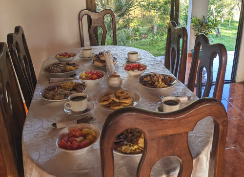
After that, we had a massive breakfast of eggs, sausage, rice, beans, fried cheese, watermelon, pineapple, papaya, peach juice and I'm sure more that I don't recall. We were told that this is a typical breakfast but I'm still not convinced. If people ate like this all the time, they'd roll up and down the paths! The food has been good and, even after a week of it, I'm not tired of the rice and beans.
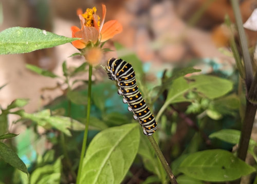
We said our goodbyes to our family and hiked across town (5 minutes) to meet the rest of our group at Finca Via Lig where they had spent the night. They had experienced a demonstration of coffee processing that we missed, but we had a very interesting tour of their small butterfly and cricket farm facilities. They raise butterfly pupas for export, and the crickets are processed as a protein food source. These are new revenue opportunities being tried to supplement the traditional farming and cattle.
A major goal of the Camino de Costa Rica is to bring tourism dollars to rural communities, rather than only the ocean beaches. These rural areas are noticeably less well off than the tourist centers. By using local homes, grocery stores, restaurants, and shuttle drivers, Fabian and Via Lig are spreading our foreign funds to many people along the way. This sort of supported long-distance hiking adventure will never have as large an audience as lounging at the beach, but it is a wonderful way for our hiking community to get out of the overcrowded spots and experience a more "In Real Life" Costa Rica which I find to be much more interesting.
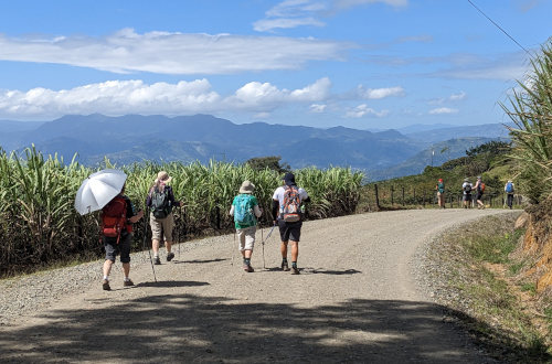
Our entrepid group's 13km dayhike started at around 9:20 with a steep climb up a gravel road over a small mountain and then down to our destination. The long climb was nice with cool shade along the way and the view out over the bowl holding the village of Pacayitas got more grand with every step upward.
Once we were over the pass at the top, a long grind down the south side gave up more views of sugar cane, coffee, and cattle farms all the way down to La Suiza. This town has the first stop light I've seen in a week! We crossed the Tius River on a pedestrian walkway in the small village of Canada and were picked up by our shuttle at the local soccer field.
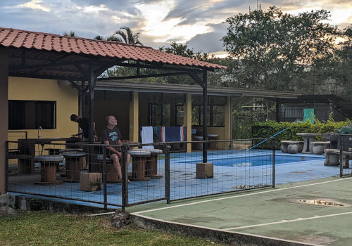
All 11 of us (9 hikers + 2 guides) are being housed in a rented private house tonight, so we have time to socialize and relax. There is a swimming pool and quite a few birds passing through the area. Fabian's family visited for the evening and grilled meat and corn for dinner. Besides comfortable beds, showers, and toilets, I should also mention that nearly every place we've stayed has WiFi.
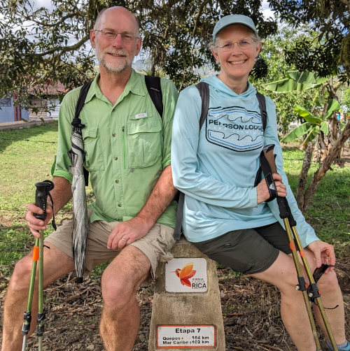
After many days of huge breakfasts, today we were offered fruit, cereal, and toasted garlic bread. Yes, garlic bread with cheese on it for breakfast! Kind of like fancy toast. It was a nice change to start the day with a lighter stomache and we really have been getting plenty of good food.
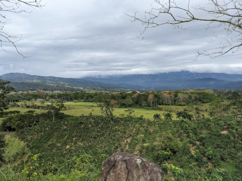
Our 16km hike took only 6 hours, including a relaxing lunch break at a restaurant along the route where I had bean soup. We started a bit before 9:30am and could have gone farther since we ended at 3:30 but the group decided to stick with the itinerary. That's one thing about hiking with a group rather than solo - I would always opt for hiking farther today since you never know what the weather will be like tomorrow. But, by stopping earlier I actually got to have more fun, so being flexible with distances and efforts is often an OK thing.
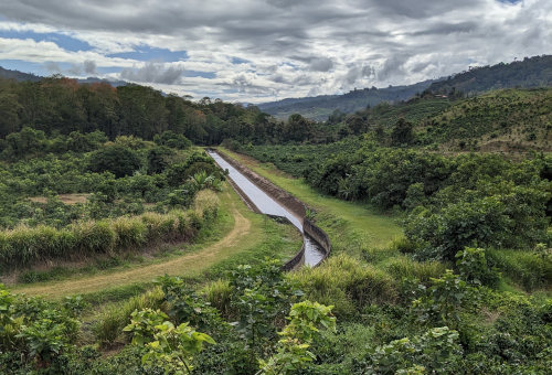
I enjoyed learning about the extensive canal system created to fill a massive hydro electric reservoir as we climbed above the artificial river and through more extensive sugar cane and coffee fields. About 99% of Costa Rica's electricity comes from renewable sources, with the majority being hydroelectric followed by geothermal. This electricity is expensive to consumers, but at least it is relatively clean. Offsetting the impressive renewable electric supply, fossil fuel demand in Costa Rica is high and growing due to the increase in vechicle use.
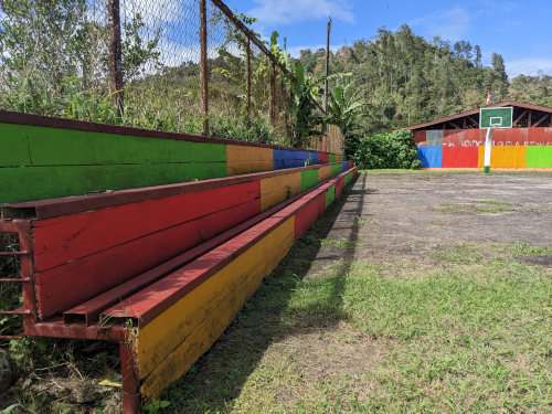
We walked through a few small villages and one very affluent large town. A church with a most colorful outdoor basketball court caught my eye. It's interesting how many different paint colors exist - and you can see all of them on the houses in this country, I believe.
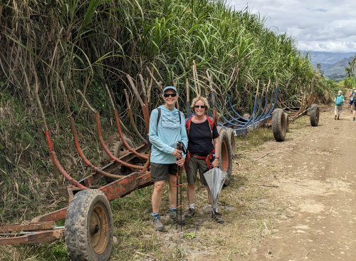
Even though we've left the banana and pineapple fields far behind, there are still plenty of sugar cane and coffee plantations to hike through. After the extra leaves and thatch are burned off sugar cane, long stalks of it are loaded onto these trailers to be hauled to the processing plant. We passed an old, abandoned plant that was evidently mismanaged and went bankrupt, so the story goes anyway. I expect merging and takeovers of businesses for more efficiency might also come into play.
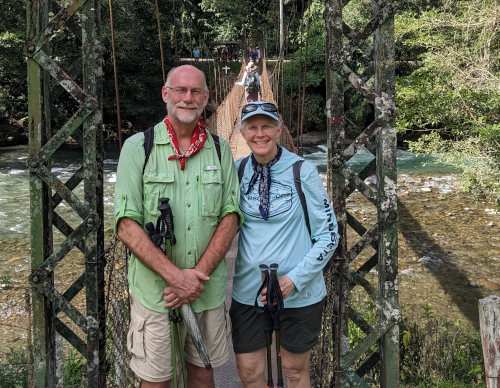
Our trek guides, Steven and Samuel, did another wonderful day of work, leading us around the countryside. My highlight of the day was to skip rocks and swim across a kayaking river with them at the end of the day right by our lodging. Our lodging at Rio del Valle is just on the hillside overlooking this river. After the chill river, I skipped a cold shower but our simple dinner of chick pea soup was nice and hot.
Back to Camino de Costa Rica Info page.
Read the Journal of Second Week on the trail.
Read some Camino Advice.
All Comments:
Dec 24, 2023 - Lynn
Dec 25, 2023 - Hiking Dude
Most of the 'trail' is dirt roads with some paved road and sidewalk walking. There is no rock scrambling and only one section of a few miles through rain forest trail that can be muddy and steeper. I had a pair of zip-off pants so I wore them as shorts the vast majority of the hike, adding the lower part just for going through a couple sections of scratchy plants. A fleece jacket came in handy a few evenings at higher elevation. I used an umbrella and my raincoat stayed in my pack the whole trip. See Costa Rica Info page for my gear list.
Jan 15, 2024 - Jody
Jan 16, 2024 - Hiking Dude
Ask a Question
Find more Hiking Resources at www.HikingDude.com


Follow Me
Recent Comments