
Solitude Trail 2020 Journal
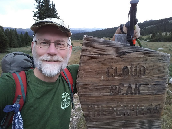
(Click any pic for large photo)
The Cloud Peak Wilderness area just west of Buffalo, Wyoming has hundreds of miles of hiking and horse trails to access mountain summits, great fishing, and remote camping. I've backpacked in the area over a dozen times, leading groups to explore the closest real mountains to Minnesota.
With the pandemic this year, our group outing was cancelled so I asked a friend to drive out with me and trek around for a few days. We decided to each do our own solo adventures, so I had four days to explore. This was the perfect opportunity to try the Solitude Trail loop.
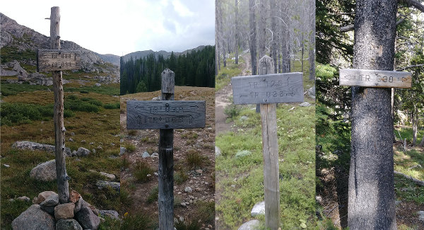
The Solitude Trail is trail #038 and it circles the Cloud Peak mountain mass for about 55 miles. It is easy to find and follow on NatGeo maps. It fluctuates from 8,500 feet up to 11,000 feet, climbing almost 10,000 feet of elevation all together. Climbing over rocky passes and dropping into drainages, the trail is marked with sporadic old blazes cut into trees, haphazard cairns, and occasional signs at trail intersections, but that's all. A map and location awareness are very important for navigation. The tread itself is very easy to see and follow for the majority of the long loop, but does fade out over high grasslands and rocky fields at times.
Since the trail surrounds high mountains, it crosses water run-off at least every few miles so water is seldom a concern. Some of the longer high portions of the route are dry, and I specifically recall the trail west of Highland Park on the northeast side. Locating a relatively flat, non-rocky camp spot can be a challenge, again more on the northeast portion because of the trail's location on the mountainside.
So, here's my thoughts about my 2020 counter-clockwise hike of the Solitude Trail... (If you'd like to read another report on the Solitude Trail, going clock-wise in 2019, please read Someday's Report which has lots more photos.)
Monday, August 3, 2020
Day: 8 miles
Trek: 8 miles total
Camp spot: Elk Lake
Drove from 5:30am to 3:30pm from Minnesota, gettig an extra hour due to timezones. After being met by a massive downpour and a long drive-thru line at the Buffalo McDonald's, we started hiking at about 4:30pm from the Hunter trailhead. There are 4 main entry points to the wilderness: north east west and south, with Hunter being the shortest drive on the east side. It also has a nicer dirt road to access it, but there is usually a lot of horse traffic. Actually, there's quite a bit of horse throughout this wilderness, on trails over which it's hard to imagine how a horse can be ridden.
While my friend got ready to hike, I headed out since we'd be on our own treks this week. Today, I hoped to cover 8 uphill miles before sunset so I wasted little time. These first few miles are outside the designated wilderness and consist of rough and rocky ATV track and horse/hiker trail that are heavily used. One mile of trail follows along, and has a wet crossing of, a man-made ditch dug in 1884 to divert Clear Creek water across the mountain to French Creek for irrigation many miles away and down the mountains. It's a very strange construction that took an immense effort to achieve. Even more impressive because the town of Buffalo, WY at the base of the mountain range was founded only a few years earlier in 1879.
By filling water from the hose and spigot at the trailhead, I won't need to filter water until tomorrow. It's also a good idea to use the pit toilet before setting out. And, don't forget to complete and deposit an official permit, in case a wilderness ranger asks to see it.
On this warm, but arid, afternoon hike through sparse, aromatic pine forest, I steadily gained elevation. The trailhead is at 7,900 feet which is the lowest point I'll be for the trek. In two miles, the trail opens onto Soldier Park which is a huge, flat, open grass field at 8650 feet. Here, the trail/road diverges with my route going north up into the forest for another mile to Triangle Park where I've camped while backpacking before.
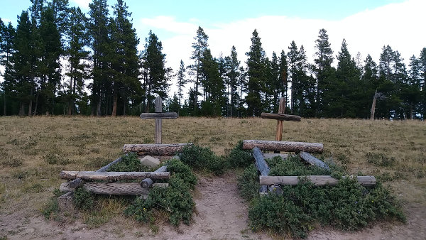
There are two graves marked in Soldier Park, ostensibly for P. Garde and Carl Johnson. Garde was a 28-year-old member of an Army survey crew in 1877 who accidentally shot himself while cleaning his gun, supposedly. Johnson was a lumberjack that had a heart attack in 1922 hiking back from a day of fishing in the Seven Brothers lakes. Neither person buried in Soldier Park was a soldier.
The trail continues to climb through 9000, 9500, and 10,000 before cresting an open, smooth ridge with my first view of the big mountains off behind Elk Lake. By now, it was nearing sunset and the weather started to get grumpy so I hustled down across the open grassland to Elk Lake to camp tonight at 9900 feet.
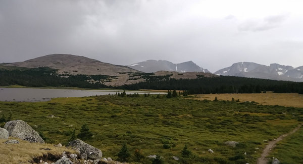
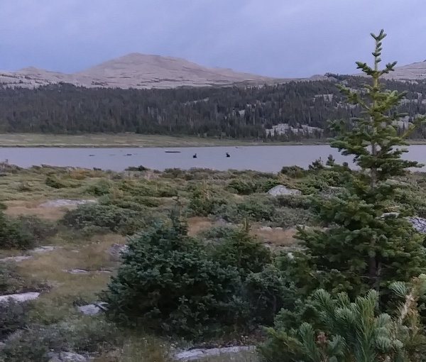
As I set up my shelter nestled in the small, wind-blasted trees, a couple young moose watched me from their evening meal in the lake. The wind picked up so I ducked inside for the night when the first rain drops started falling.
Since I sat in the car ride all day, and I'm excited for my trek, and I'm at elevation, all the wind, rain, lightning, and thunder keep me up most of the night. Unfortunately, I figure I actually got around three hours of sleep all together. Not a great way to prepare for a long day of mountain hiking, and I will pay for it soon enough.
Tuesday, August 4, 2020
Day: 19 miles
Trek: 27 miles total
Camp spot: Cross Creek
I was up before the sun. Actually, that's when I decided to get moving - I was awake well before that. Being greeted to blue skies and brightness to the east is a great way to start any day. After the storm, this was even better.
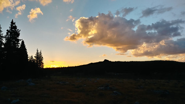
When going solo, it takes me about ten minutes to pack everything and get out of my tent. Then, another 5 minutes to pack the tent, and I'm moving down the trail in 15 minutes. While packing, I keep a couple granola bars and snacks in my pant pockets and eat them when I get hungry. I rarely eat anything before I start hiking and, after two McDonald's meals last night, I've already got calories to burn.
One of moose from last night was out and about, keeping an eye on me as I left. There were also a group of seven elk in the open area ahead as I left the lake. The moms in the group gave a few short bellows as they guided the four youngesters into the forest. Later in the day, I saw a grey blur through the trees which I believe was a coyote - no bounding or flapping, just a smooth flow through the few openings. Other than that, I saw dozens of squirrels and chipmunks but nothing larger today.
Heading north from Elk Lake, I was now actually on the Solitude Trail as it leaves the designated wilderness and becomes a rocky, obnoxious path obstinantly dropping in elevation for 4.5 miles to the man-made Willow Reservoir. There is a nice bridge crossing the inflow and the area around the reservoir gets a lot of traffic, but there's not much else to say - except that the National Geographic Cloud Peak map is totally messed up at this point.
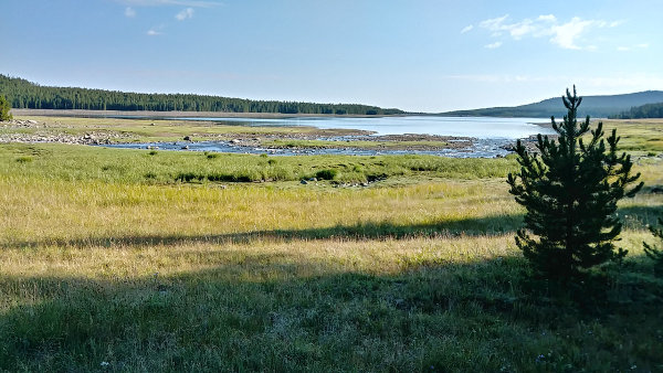
Circling around to the north side of the reservoir, a trail for motorcycles is shown on the map. It does not exist. I walked a quarter mile past the spot on the map, searching intently for any sign. Then, I came back for a half mile, scanning the forest for any indication of a path. I finally returned to the spot on the map and started bushwhacking north through the forest. The contour lines showed it was all downhill for about a mile until I crossed Kearney Creek and had to T into another trail where I would turn left and follow it west.
I zigzagged east to west and back as I moved north, trying to find any sign of a trail, for the next half hour. Then, I gave up and just plowed ahead northward, hitting the creek, and finding a few small down trees to cross on. It did not look like anyone else had used them, so I was just lucky to find them. After crossing the creek, I immediately found the new trail and was back on track.
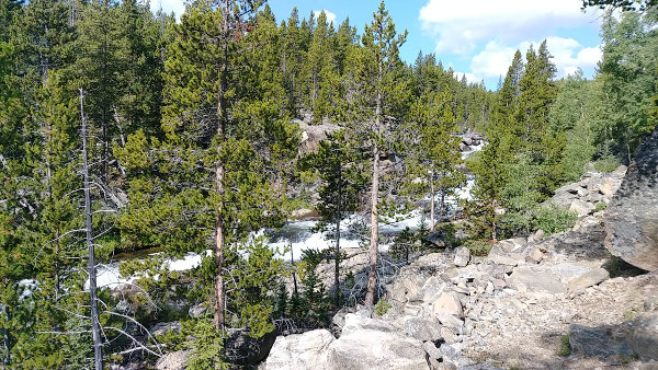
Note: Upon returning home and scrutinizing google earth images, I can see a bridge over Kearny Creek about a half mile farther northeast and the trail appears to originate at the dammed east end of the reservoir. I would recommend hiking all the way to the dam to find the trail.
From here, the trail was easy to follow as it climbed along beautiful Kearny Creek to the Kearny Reservoir where I stopped to filter my first water with a nice view of Penrose Peak to the southwest. This time of year, the reservoirs tend to be very low.
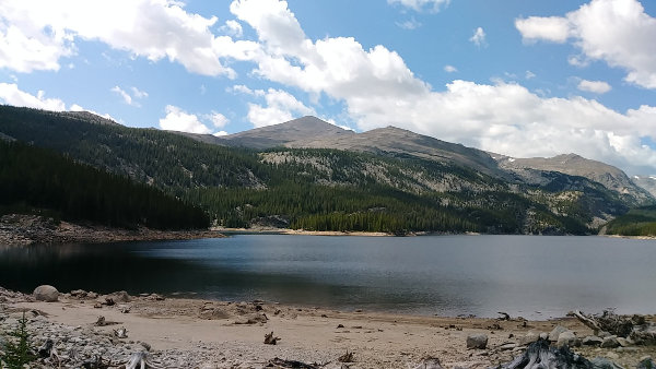
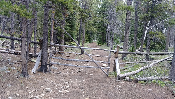
After 10 miles outside the wilderness, it was nice to pass through this gate back into the non-vehicular trail system. The trail leaves the wilderness again for less than two miles, but the rest is contained.
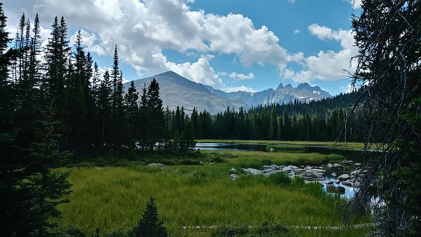
The next landmark is Lake Winnie which is a cute pond with a wonderful view of Penrose Peak and Blacktooth Mountain at 13,005 feet. Cloud Peak is higher, but a bit behind it so it won't be visible until I hike more miles around this huge mass of rock.
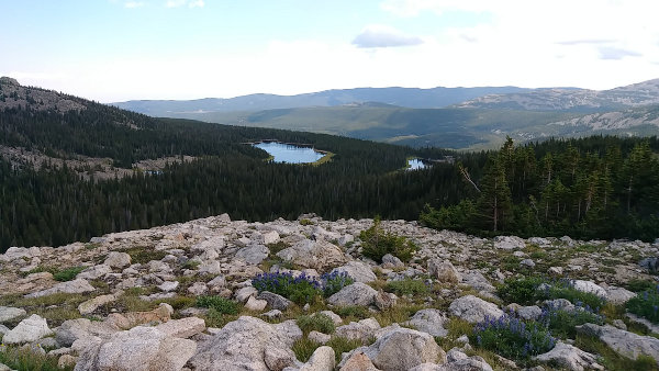
A 400 foot rise around an inverted horseshoe-shaped mountainside made the climb up to Highland Park bearable. No, it was not easy, but bearable. From Highland Park, I could see back down to Lake Winnie and the distant forest I had traversed earlier.
But, looking ahead was much better. The views of the high mountain range were excellent with Penrose Peak and Black Tooth Mountain standing out. Opening onto Highland Park, the trail was a gentle rise across a spacious grassland to 10,400 feet. Here, I met the first other hikers of my trek - two young men heading in to a remote lake for fishing. Over the next two days, I would see about 30 people on trail and four of them were hiking the entire Solitude loop.
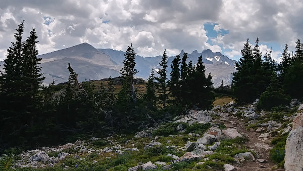
From leaving Lake Winnie and crossing Highland Park, the trail traversed a long, rocky, dry hillside. This 5.5 mile section was the longest I recall without easy water. It might be a good idea to fill water before starting this section. The trail was nice with large cairns to mark the way if snow is still around, and there were expansive views to lower forest in the north.
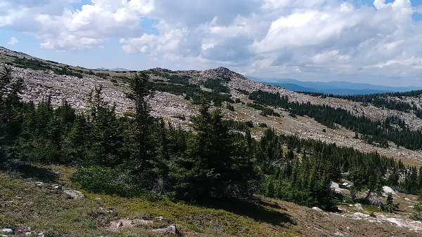
From here, the trail dropped on a very long slope to the Cross Creek crossing outside the wilderness. My lack of sleep, the 2500+ feet of elevation gain, and 19 miles talked me into stopping here for the night even though it was only 5:30. I had hiked less than 12 hours, but my legs did not want to do another 300 foot climb today. Just after a wet crossing, there is a large, flat, highly impacted horse campsite so I used it. Tonight, I spent almost 12 hours resting in my tent, and actually slept almost 9 hours!
Wednesday, August 5, 2020
Day: 18 miles
Trek: 45 miles total
Camp spot: Lake Solitude
I got off to an early start and felt great. The trail continued west over a rise, completely sheltered in forest, to the Coffen Park access area. Here, the trail takes a sharp turn and heads due south for the next 7.5 miles. The trail is well-maintained and highly used so the miles rolled by as I gained elevation up to Lake Geneva. Keep your eyes open for remains of a few old log cabins through here.
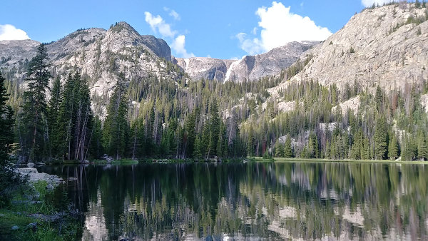
Each day has a few climbs and a few drops as this Solitude loop trail crosses the ridges and drainages of the Cloud Peak structure. This part of the trail is a steady rise up a valley to Geneva Pass which separates the north from the south drainages. At the south end of Lake Geneva, the trail hits rock and needs to climb over it. The 1000 foot climb to the pass is broken into two 500 foot steep sections with a beautiful meadow between them. It is a wonderful stretch of trail, but only a teaser for the top of the pass if the weather is nice.
A couple year ago, a bad wind storm tore through here, knocking most of the forest down. It's a mess, and will be a fire hazard for awhile, but the trail is clear.
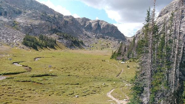
Once the final push through that low dip you can see in the horizon brings you to the pass, the southern expanse opens up and you can quickly forget about aching legs and sweating back while you take a nice, long rest by the cairn at the top. The next 5 miles is a long, gentle glide down to Teepee Pole Flats, with a couple of wet crossings to cool off hot feet along the way.
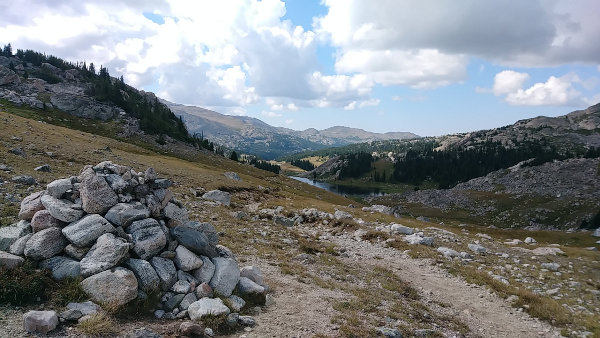
The open areas of the west and south sides of the mountains are certainly the most arid here. Dust from horses can get quite thick on the trail and the smell of pine sap is strong on a warm afternoon. The few wet stream crossings provided nice breaks in the routine of hiking, but I didn't drink nearly enough water while walking this day and ran low on energy as I approached Lake Solitude.
I also met two groups of hikers, one heading out to the Battle Park trailhead and one going my way to the east end of Lake Solitude.
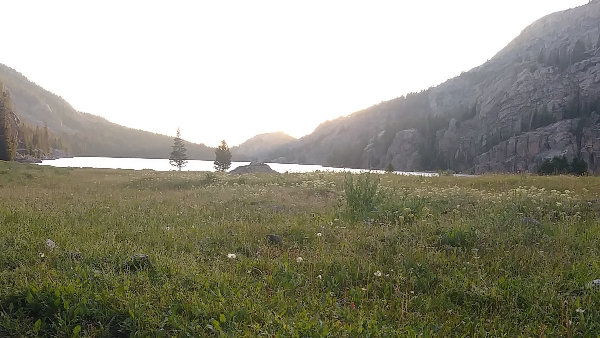
I reached the well-known, well-used, highly-impacted camping area often used by horse riders on Lake Solitude around 5:30. The next two miles of trail are a tough climb up to Mistymoon Lake which is a high-use area in which I did not care to camp. So, I ended my day early - still lots of light, but not much steam in the engine. Tomorrow will start with a climb.
Thursday, August 6, 2020
Day: 11 miles
Trek: 56 miles total
Camp spot: Seven Brothers Crossing
Camping at lower elevations has some benefits: tends to be warmer, less windy, easier water, and a climb to warm you up first thing in the morning. Leaving Solitude, I immediately had a wet crossing before the 1,000 foot climb up to the base of Cloud Peak. Along the way, a few waterfalls and some nice views back down the steep valley offered nice sights.
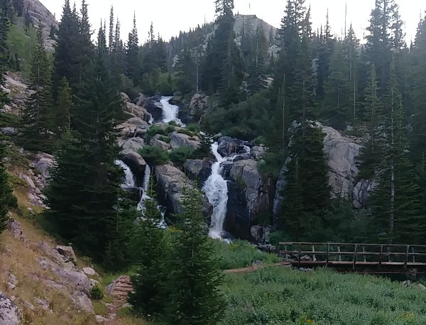
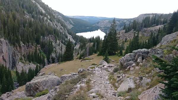
From the base of Cloud Peak, hikers start their day hike to the 13,000+ foot summit. I skipped that side trip this time, but I did see at least seven people starting up a bit late in the morning and with dark clouds building. With no shelter but rocks the entire way, it's not a good place to be caught in weather. Just a day ago, I was on the far side of this mountain.
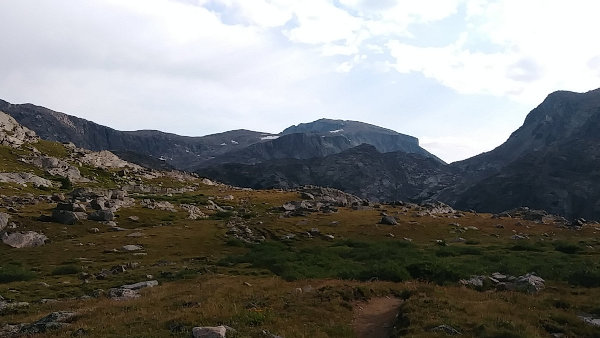
This drainage area around Mistymoon Lake gets an extreme amount of use. It is now required to pack out human waste from here, in hopes of reducing the amount of overnight stays. When I hiked through around 9am, there were four separate groups and about 11 people. There were also two moose bedded down in the shrubs.
On the trail up from Mistymoon to Florence Pass in the east, which would be the highest point on the trail at 11,000 feet, I nearly missed this moose laying by one of the Fortress Lakes. He couldn't care less about me walking past, especially since we had plenty of distance between us and I was very slowly plodding up the hill.
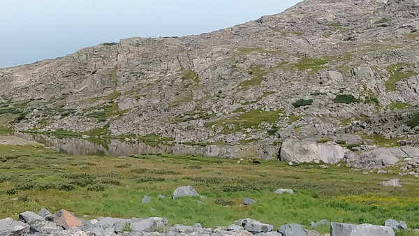
Much of the trail through the wilderness was created around 80 years ago by the Civilian Conservation Corp, along with fire lookouts, campgrounds, dams, and bridges in the area. Along Lake Solitude and up to Florence Pass, it is obvious that the trail took many hours of rock work to complete. All that effort years ago grants us the opportunity to enjoy scenery like this today. This is Gunboat Lake and Elk Mountain in the background from the Solitude Trail nearing Florence Pass.
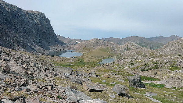
I reached the pass almost 90 minutes sooner than expected. After two days of hiking, I've gotten my pace down and the uphill miles today slowly passed under my relentless steps. Florence Lake at the highpoint surprisingly has a nice fishery and is a great place for a rest break.
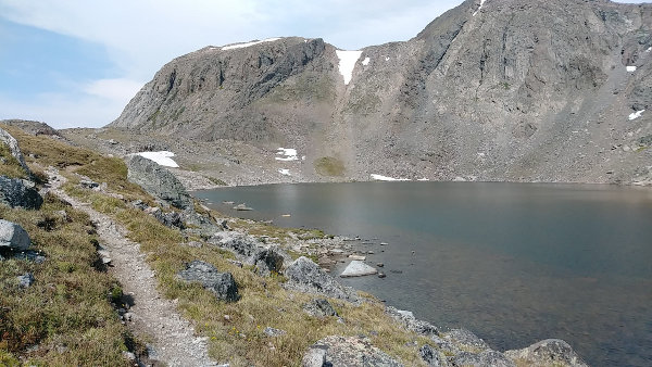
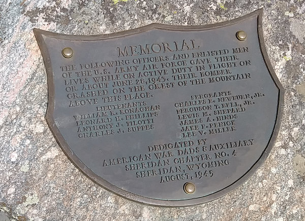
Directly to the north is Bomber Mountain which is another popular day hike. Wreckage from a WWII plane can still be found scattered across the domed summit. A plaque memorializing the crash is riveted to a large stone by the trail and has been there since 1945.
From this highest point of my hike, it is pretty much all downhill past more waterfalls, over rocky obstacles, and through lush forest - just more of the same. At the far southeast corner of the Solitude Trail, I continued east rather than doing the last 5 miles north over Ant Hill back to Elk Lake. I've done that stretch a handful of times and bad weather was brewing to the west. I didn't want to get caught far above timberline on my last evening.
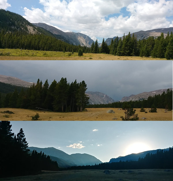
I found where my friend was camping where the trail to Seven Brothers lakes crosses Clear Creek and set up my shelter. Over the next couple hours, the storm grew to the west, blasted through camp with high winds, heavy rain, and some thunder - and then cleared out again. I was glad to not be up on the trail. This is what it looked like before, during, and sunset after...
Friday, August 7, 2020
Day: 6 miles
Trek: 62 miles total
Camp spot: home
The final morning started with a wake-up at 5:00am and hiking by 5:30. A couple hours of downhill hiking in the cool air and I wound up back where I started. We were back at Hunter trailhead by 8:00am and home in Minnesota before sunset.
The Solitude Trail offers a nice trek through the closest real mountains to the midwest. The northeast portion of it is not very interesting but the vast majority of the loop is a great trail with many places to rest, gaze, fish, and explore. There is certainly less air up this high so slowing down a bit is advisable. The weather can and does change often, sometimes violently, so keeping an eye on the sky is important. The trail is well-marked for the most part, but a handheld gps device is a good backup to maps - I used a free trail app on my cellphone and it works just fine as a reassurance of my location.
You can see the track of my trek HERE and there's another track at AllTrails.
Hike On!
All Comments:
Mar 09, 2021 - Greg
Aug 20, 2021 - Susan
Aug 20, 2021 - Greg
Aug 24, 2021 - Hiking Dude
Ask a Question
Find more Hiking Resources at www.HikingDude.com


Follow Me
Recent Comments